
IMAGES TAKEN NEAR TO
The Rowans, BURGESS HILL, RH15 8UZ
Introduction
This page details the photographs taken nearby to The Rowans, RH15 8UZ by members of the Geograph project.
The Geograph project started in 2005 with the aim of publishing, organising and preserving representative images for every square kilometre of Great Britain, Ireland and the Isle of Man.

There are currently over 7.5m images from over14,400 individuals and you can help contribute to the project by visiting https://www.geograph.org.uk
Image Map
Images are licensed for reuse under creativecommons.org/licenses/by-sa/2.0
Notes
- Clicking on the map will re-center to the selected point.
- The higher the marker number, the further away the image location is from the centre of the postcode.
Image Listing (25 Images Found)
Images are licensed for reuse under creativecommons.org/licenses/by-sa/2.0
Image
Details
Distance
1
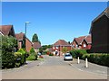
The Rowans, Burgess Hill
Small cul de sac off The Acorns and part of a large area of housing constructed from the late 1990s onwards within the boundaries of a new bypass.
Image: © Simon Carey
Taken: 22 Jul 2014
0.01 miles
2
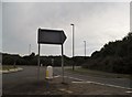
Roundabout at the end of the A2300, Burgess Hill
This is at the western ring road which goes round half of Burgess Hill between Wivelsfield and Hurstpierpoint, but if you are actually making that trip it is a lot shorter to take the direct route unless it's in the rush hour.
Image: © David Howard
Taken: 9 Aug 2018
0.05 miles
3
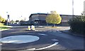
Triangle Leisure Centre
The Triangle Leisure Centre in Burgess Hill.
Image: © Chris Thomas-Atkin
Taken: 5 Nov 2017
0.07 miles
4

Recycling Area, Triangle Way, Burgess Hill
Near the leisure centre though not much in terms of what you can recycle.
Image: © Simon Carey
Taken: 22 Jul 2014
0.08 miles
5
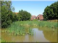
Pond, Primrose close, Burgess Hill
An old pond that predates the estate it now forms part of.
Image: © Simon Carey
Taken: 22 Jul 2014
0.09 miles
6
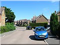
Foxglove Close, Burgess Hill
Part of the housing estate built after the construction of the bypass in the late 1990s.
Image: © Simon Carey
Taken: 22 Jul 2014
0.09 miles
7
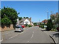
The Oaks, Burgess Hill
Part of a large housing development built within the confines of a new bypass from the late 1990s. Once part of a field called Flat Four Acres according to Hurstpierpoint's 1842 tithe map.
Image: © Simon Carey
Taken: 22 Jul 2014
0.10 miles
8
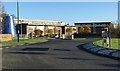
St Paul?s
St Paul’s Catholic College in Burgess Hill.
Image: © Chris Thomas-Atkin
Taken: 5 Nov 2017
0.10 miles
9
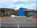
St Paul's Roman Catholic College
Opened in September 2004 and therefore not marked on the current OS map. This entrance is on the northern side of the A2300/A273 roundabout opposite The Triangle leisure centre. St Paul's opened in Haywards Heath during the mid 1960s and transferred to Burgess Hill having been offered this greenfield site.
Image: © Simon Carey
Taken: 26 Aug 2006
0.12 miles
10
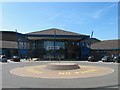
The Triangle Leisure Centre, Burgess Hill
Opened in 1999 and home to indoor and outdoor swimming pools, badminton and squash courts, and outdoor all weather pitches and tennis courts. There are also conference facilities available.
Image: © Simon Carey
Taken: 22 Jul 2014
0.13 miles