IMAGES TAKEN NEAR TO
Fairfield Road, BURGESS HILL, RH15 8NT
Introduction
This page details the photographs taken nearby to Fairfield Road, RH15 8NT by members of the Geograph project.
The Geograph project started in 2005 with the aim of publishing, organising and preserving representative images for every square kilometre of Great Britain, Ireland and the Isle of Man.

There are currently over 7.5m images from over14,400 individuals and you can help contribute to the project by visiting https://www.geograph.org.uk
Image Map
Images are licensed for reuse under creativecommons.org/licenses/by-sa/2.0
Notes
- Clicking on the map will re-center to the selected point.
- The higher the marker number, the further away the image location is from the centre of the postcode.
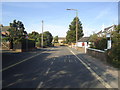
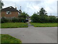
Image Listing (4 Images Found)
Images are licensed for reuse under creativecommons.org/licenses/by-sa/2.0
Image
Details
Distance
2
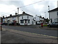
Looking across West Street to Downs Road, Burgess Hill
Downs Road is a cul-de-sac, leads to St John's Common.
Image: © Ruth Sharville
Taken: 26 Sep 2023
0.18 miles
3
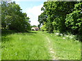
Path from St John's Common to Commercial Road
Image: © Ruth Sharville
Taken: 26 Sep 2023
0.23 miles