IMAGES TAKEN NEAR TO
Valebridge Road, BURGESS HILL, RH15 8AU
Introduction
This page details the photographs taken nearby to Valebridge Road, RH15 8AU by members of the Geograph project.
The Geograph project started in 2005 with the aim of publishing, organising and preserving representative images for every square kilometre of Great Britain, Ireland and the Isle of Man.

There are currently over 7.5m images from over14,400 individuals and you can help contribute to the project by visiting https://www.geograph.org.uk
Image Map (Loading...)


Getting Data...Please wait
Leaflet Map data © OpenStreetMap
Images are licensed for reuse under creativecommons.org/licenses/by-sa/2.0
Notes
- Clicking on the map will re-center to the selected point.
- The higher the marker number, the further away the image location is from the centre of the postcode.
Image Listing (36 Images Found)
Images are licensed for reuse under creativecommons.org/licenses/by-sa/2.0
Image
Details
Distance
1
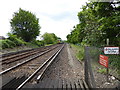
Looking south on the railway towards Wivelsfield station
Image: © Shazz
Taken: 24 May 2016
0.01 miles
2
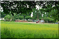
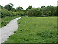
Home Field, Bedelands
Part of the local nature reserve of several fields and woods, but this one not open to the public. Beyond is the local council's Bedelands Caravan Park (so called).
Image: © Robin Webster
Taken: 8 Jun 2007
0.05 miles
3
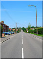
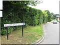
Valebridge Road, Worlds End
The opposite view to this Image All this land was once part of Valebridge Common with the road being the main thoroughfare through it to the southern edge of another common at Haywards Heath. However, the common land was gradually eaten away by the enclosures then the coming of the London-Brighton railway in 1841 and the subsequent town of Burgess Hill that grew around it. What remains of the common can be found on Bedelands Farm Nature Reserve.
Image: © Simon Carey
Taken: 8 Jun 2008
0.07 miles
4
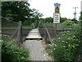
Unmanned pedestrian crossing over the London to Brighton line
Image: © Dave Spicer
Taken: 15 May 2011
0.08 miles
5
Footpath 101CR west into Bedelands Farm Nature Reserve
Image: © Dave Spicer
Taken: 15 May 2011
0.08 miles
7
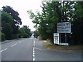
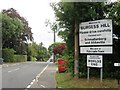
Road into Worlds End
Viewed from Valebridge Road looking south towards World's End.
Image: © Nigel Freeman
Taken: 12 Jul 2005
0.09 miles
8
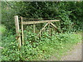
Old level crossing gate
Being used as a fence panel on footpath 101CR.
Image: © Dave Spicer
Taken: 15 May 2011
0.09 miles
10
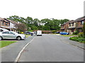
Entrance to Worlds End, Burgess Hill
Image: © Alex McGregor
Taken: 13 Aug 2014
0.10 miles