
IMAGES TAKEN NEAR TO
Hunters Gate, REDHILL, RH1 4HT
Introduction
This page details the photographs taken nearby to Hunters Gate, RH1 4HT by members of the Geograph project.
The Geograph project started in 2005 with the aim of publishing, organising and preserving representative images for every square kilometre of Great Britain, Ireland and the Isle of Man.

There are currently over 7.5m images from over14,400 individuals and you can help contribute to the project by visiting https://www.geograph.org.uk
Image Map
Images are licensed for reuse under creativecommons.org/licenses/by-sa/2.0
Notes
- Clicking on the map will re-center to the selected point.
- The higher the marker number, the further away the image location is from the centre of the postcode.
Image Listing (74 Images Found)
Images are licensed for reuse under creativecommons.org/licenses/by-sa/2.0
Image
Details
Distance
1
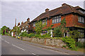
High Street
Houses on the north side of High Street, Nutfield
Image: © Ian Capper
Taken: 9 May 2009
0.03 miles
2
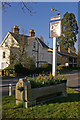
Horse trough
Outside the Queens Head pub. Except for a date (1899) the writing is not legible even when viewed close up. However, it follows the design of a number of troughs in the area provided by the Metropolitan Drinking Fountain and Cattle Trough Association. See Image for a wider view.
Image: © Ian Capper
Taken: 17 Apr 2008
0.03 miles
3
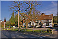
The Queens Head
An old posting inn on the A25 through Nutfield. The building dates from the 16th century with 19th century restoration and extension. It is grade II listed - for listing particulars see www.historicengland.org.uk/listing/the-list/list-entry/1029867. To the right of the inn sign can be seen an old water trough, now used for flowers - see Image for closeup. The oak tree in the centre of the photo was planted in 1877 to celebrate Queen Victoria's 40th anniversary as Queen.
Image: © Ian Capper
Taken: 17 Apr 2008
0.03 miles
4
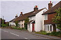
High Street
Cottages on the north side of High Street, Nutfield. The central portion of the terrace in the photo dates from the 17th century and is grade II listed - for listing particulars see www.historicengland.org.uk/listing/the-list/list-entry/1029869.
Image: © Ian Capper
Taken: 9 May 2009
0.04 miles
5
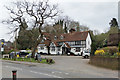
The Queens Head, Nutfield
A grade II listed building, east wing 16th century, west wing 17th, plus later additions and alterations.
Image: © Robin Webster
Taken: 23 Mar 2019
0.04 miles
6
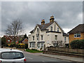
House on High Street, Nutfield
On the north side.
Image: © Robin Webster
Taken: 23 Mar 2019
0.04 miles
7
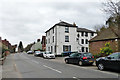
The White House, High Street, Nutfield
Flats, whether it was once something else I cannot find out.
Image: © Robin Webster
Taken: 23 Mar 2019
0.05 miles
8
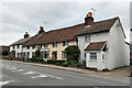
Cottages and Old Bakery, Nutfield
On the High Street. The centre part of the row with a steeper roof is a grade II listed building, 17th century, refaced in 19th century.
Image: © Robin Webster
Taken: 23 Mar 2019
0.05 miles
9
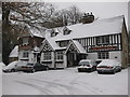
The Queens Head, Nutfield
Pub/restaurant: 13, High Street, Nutfield, Redhill, Surrey RH1 4HH
Image: © Rib
Taken: 1 Dec 2010
0.06 miles
10
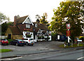
Nutfield: The 'Queen's Head'
On the south side of the A25.
Image: © Dr Neil Clifton
Taken: 17 Oct 2014
0.06 miles