
IMAGES TAKEN NEAR TO
Gillmans Industrial Estate, Natts Lane, BILLINGSHURST, RH14 9EZ
Introduction
This page details the photographs taken nearby to Gillmans Industrial Estate, Natts Lane, RH14 9EZ by members of the Geograph project.
The Geograph project started in 2005 with the aim of publishing, organising and preserving representative images for every square kilometre of Great Britain, Ireland and the Isle of Man.

There are currently over 7.5m images from over14,400 individuals and you can help contribute to the project by visiting https://www.geograph.org.uk
Image Map
Images are licensed for reuse under creativecommons.org/licenses/by-sa/2.0
Notes
- Clicking on the map will re-center to the selected point.
- The higher the marker number, the further away the image location is from the centre of the postcode.
Image Listing (38 Images Found)
Images are licensed for reuse under creativecommons.org/licenses/by-sa/2.0
Image
Details
Distance
1
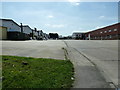
Gillmans Industrial Estate
Off Natts Lane.
Image: © Dave Spicer
Taken: 9 Apr 2011
0.02 miles
2
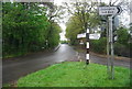
Fingerpost, Natts Lane and Lower Station Rd junction
Image: © N Chadwick
Taken: 6 May 2012
0.07 miles
3
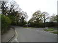
Lower Station Road, junction with Natts Lane, Billingshurst
Image: © Stacey Harris
Taken: 4 May 2012
0.07 miles
4

Natts Lane, Billingshurst
Looking into Natts Lane from its junction with Lower Station Road and Marringdean Road.
Image: © Stephen McKay
Taken: 30 Jul 2025
0.08 miles
5
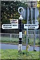
Direction Sign ? Signpost
Located on a grass triangle on the west side of the junction of Natts Lane, Marringdean Road and Lower Station Road in Billingshurst parish. 3 arms and annulus finial. See also https://www.geograph.org.uk/photo/2957764.
Milestone Society National ID: SX_TQ0824
Image: © J Chisholm
Taken: 20 Oct 2019
0.08 miles
9
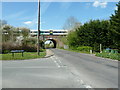
Southbound train having just left Billingshurst Station
The bridge is over Natts Lane and amongst the trees on the right is Par Brook which gives it name to Parbrook, part of Billingshurst.
Image: © Dave Spicer
Taken: 9 Apr 2011
0.14 miles
10
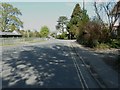
Lower Station Road Billingshurst
The station is at the top of the road by the level crossing.
Image: © Dave Spicer
Taken: 9 Apr 2011
0.15 miles