IMAGES TAKEN NEAR TO
Guildford Road, BILLINGSHURST, RH14 0SE
Introduction
This page details the photographs taken nearby to Guildford Road, RH14 0SE by members of the Geograph project.
The Geograph project started in 2005 with the aim of publishing, organising and preserving representative images for every square kilometre of Great Britain, Ireland and the Isle of Man.

There are currently over 7.5m images from over14,400 individuals and you can help contribute to the project by visiting https://www.geograph.org.uk
Image Map
Images are licensed for reuse under creativecommons.org/licenses/by-sa/2.0
Notes
- Clicking on the map will re-center to the selected point.
- The higher the marker number, the further away the image location is from the centre of the postcode.
Image Listing (26 Images Found)
Images are licensed for reuse under creativecommons.org/licenses/by-sa/2.0
Image
Details
Distance
1
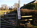
Footpath by Loxwood chapel
The notices concern the temporary closure of public rights of way for maintenance. For other notices about these closures see Image
Image: © Shazz
Taken: 9 Jan 2011
0.16 miles
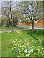
5
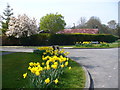
Pound Close, Loxwood
Road end on Spy Lane with spring flowers and tree blossom brightening the village scene.
http://www.loxwood.org/
Image: © Colin Smith
Taken: 24 Apr 2010
0.17 miles
6
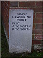
Grave Measuring Point
This is at the chapel in Loxwood.
Image: © Shazz
Taken: 9 Jan 2011
0.17 miles
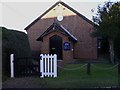
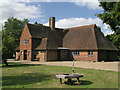
7
South east corner of chapel at Loxwood
The chapel belongs to the Emmanuel Fellowship.
Image: © Shazz
Taken: 9 Jan 2011
0.17 miles
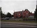
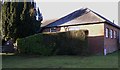
8
Loxwood Village Hall
Also known as North Hall. Near the junction with Spy Lane.
Image: © Andy Potter
Taken: 18 Sep 2006
0.18 miles
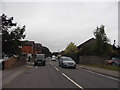
9

New houses on the western edge of Loxwood
Image: © Dave Spicer
Taken: 5 Dec 2009
0.19 miles
10
Nicholsfield, Loxwood
Grassy corner at the junction with Station Road, leading to modern residential development.
http://www.loxwood.org/
Image: © Colin Smith
Taken: 24 Apr 2010
0.20 miles