IMAGES TAKEN NEAR TO
Cornwood, Townfield, BILLINGSHURST, RH14 0NP

Introduction

This page details the photographs taken nearby to Cornwood, Townfield, RH14 0NP by members of the Geograph project.

The Geograph project started in 2005 with the aim of publishing, organising and preserving representative images for every square kilometre of Great Britain, Ireland and the Isle of Man.

There are currently over 7.5m images from over14,400 individuals and you can help contribute to the project by visiting https://www.geograph.org.uk

Image Map


Images are licensed for reuse under creativecommons.org/licenses/by-sa/2.0
Notes
  • Clicking on the map will re-center to the selected point.
  • The higher the marker number, the further away the image location is from the centre of the postcode.

Image Listing (93 Images Found)

Images are licensed for reuse under creativecommons.org/licenses/by-sa/2.0
  • ...
Image
Details
Distance
1
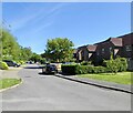
Cornwood, Kirdford
A cul de sac off Townfield that was built in 1990.
Image: © Simon Carey Taken: 25 May 2024
0.01 miles
2
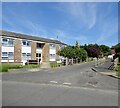
School Court, Kirdford
A cul de sac off Townfield that was built on the former site of Kirdford Primary School that had closed in 2001. The flats line the former entrance to the school with the new development just visible beyond.
Image: © Simon Carey Taken: 25 May 2024
0.05 miles
3
Play area, Kirdford
Utilising the former school field of Kirdford Primary School that closed in 2001.
Image: © Simon Carey Taken: 25 May 2024
0.05 miles
4
The Half Moon Kirdford
Image: © Dave Spicer Taken: 17 Oct 2009
0.07 miles
5
Story of Kirdford
Historical calendar of main village events on a plaque at the foot of the village sign.
Image: © Colin Smith Taken: 15 Mar 2009
0.08 miles
6
Road junction on bend in Kirdford
Image: © Dave Spicer Taken: 17 Oct 2009
0.08 miles
7
Story of Kirdford Part Two
Following on from Colin Smiths photo Image the southern side shows the modern story of Kirdford
Image: © Dave Spicer Taken: 17 Oct 2009
0.08 miles
8
Autumn in Kirdford
Image: © Basher Eyre Taken: 25 Oct 2010
0.09 miles
9
Degradation of Drunkeness
Inscription on wall of private house
Image: © Dave Spicer Taken: 17 Oct 2009
0.09 miles
10
Kirdford
The village sign stands at the T-junction at the village centre. It carries a glass diamond to commemorate the medieval French glassworkers in this Low Wealden village. http://www.ukvillages.co.uk/village/Kirdford-West%20Sussex
Image: © Colin Smith Taken: 15 Mar 2009
0.09 miles
  • ...