IMAGES TAKEN NEAR TO
Nursery Green, BILLINGSHURST, RH14 0EQ
Introduction
This page details the photographs taken nearby to Nursery Green, RH14 0EQ by members of the Geograph project.
The Geograph project started in 2005 with the aim of publishing, organising and preserving representative images for every square kilometre of Great Britain, Ireland and the Isle of Man.

There are currently over 7.5m images from over14,400 individuals and you can help contribute to the project by visiting https://www.geograph.org.uk
Image Map
Images are licensed for reuse under creativecommons.org/licenses/by-sa/2.0
Notes
- Clicking on the map will re-center to the selected point.
- The higher the marker number, the further away the image location is from the centre of the postcode.
Image Listing (19 Images Found)
Images are licensed for reuse under creativecommons.org/licenses/by-sa/2.0
Image
Details
Distance
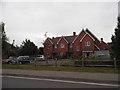
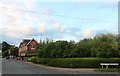
1

New houses on the western edge of Loxwood
Image: © Dave Spicer
Taken: 5 Dec 2009
0.10 miles
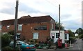
4
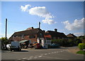
Loxwood Village Stores
The Loxwood village stores in the east of this square were originally the Combination Stores, established by the Society of Dependents ('Cokelers'), a religious movement founded by John Sirgood.
Loxwood and the surrounding area once supported a significant population of Dependents, after Sirgood moved here from Kennington in south London in 1850. The shops are now privately owned and only a handful of Cokelers remain in the area.
Image: © Dan Gregory
Taken: 31 Jul 2007
0.18 miles
5
Houses at Loxwood Farm Place
These homes were built in the late 1990's on the site of Loxwood Place Farm.
Image: © Shazz
Taken: 9 Jan 2011
0.19 miles
6
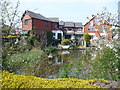
The Pond, Loxwood
Exclusive housing development around the pond in the centre of Loxwood.
http://www.loxwood.org/
Image: © Colin Smith
Taken: 24 Apr 2010
0.19 miles
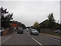
8
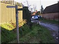
Bridleway at Loxwood
This bridleway passes by Loxwood Farm Place to the High Street which is where the cars are in this picture.
Image: © Shazz
Taken: 9 Jan 2011
0.20 miles
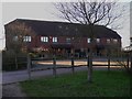
10
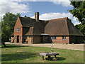
Loxwood Village Hall
Also known as North Hall. Near the junction with Spy Lane.
Image: © Andy Potter
Taken: 18 Sep 2006
0.21 miles