
IMAGES TAKEN NEAR TO
Worsted Green, REDHILL, RH1 3PW
Introduction
This page details the photographs taken nearby to Worsted Green, RH1 3PW by members of the Geograph project.
The Geograph project started in 2005 with the aim of publishing, organising and preserving representative images for every square kilometre of Great Britain, Ireland and the Isle of Man.

There are currently over 7.5m images from over14,400 individuals and you can help contribute to the project by visiting https://www.geograph.org.uk
Image Map
Images are licensed for reuse under creativecommons.org/licenses/by-sa/2.0
Notes
- Clicking on the map will re-center to the selected point.
- The higher the marker number, the further away the image location is from the centre of the postcode.
Image Listing (43 Images Found)
Images are licensed for reuse under creativecommons.org/licenses/by-sa/2.0
Image
Details
Distance
1
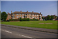
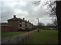
Shale Green, Merstham
Part of the 1950s London overspill estate built to the east of Merstham village.
Image: © Ian Capper
Taken: 8 Jun 2008
0.06 miles
2
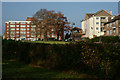
Merstham, Surrey
Looking towards Portland Drive, across a small 'village' green.
Image: © Peter Trimming
Taken: 10 Dec 2013
0.07 miles
3
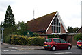
Merstham: St. Teresa of the Child Jesus R C Church
Image: © Dr Neil Clifton
Taken: 16 Sep 2012
0.09 miles
4
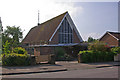
The Catholic Church of St Teresa of the Child Jesus, Merstham
Completed in 1959 to serve Roman Catholics in Merstham, following its rapid expansion in the 1950s due to the building of a London overspill estate here. It was designed by Tim Alleyn. Between 1953 and 1959 the local catholics had met at Canada Hall (see Image). Although opened on 7 October 1959, the church was not formally consecrated until 10 October 1975, the delay apparently being because of a requirement that a church should be free of debt before being consecrated.
Image: © Ian Capper
Taken: 8 Jun 2008
0.09 miles
5

Nailsworth Crescent
The rear of 1950s housing in Nailsworth Crescent, viewed from by the junction of Portland Drive with Bletchingley Road.
Image: © Ian Capper
Taken: 7 May 2009
0.09 miles
7
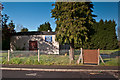
Merstham Baptist Church
The temporary church building, pending rebuilding on the site of the original building in the area to the right of this photo (see Image).
Image: © Ian Capper
Taken: 21 Apr 2012
0.10 miles
8
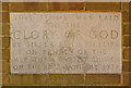
Foundation stone for Merstham Baptist Church
Image: © Ian Capper
Taken: 8 Jun 2008
0.11 miles
9
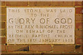
Foundation stone for Merstham Baptist Church
Image: © Ian Capper
Taken: 8 Jun 2008
0.11 miles
10
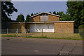
Merstham Baptist Church
Built in 1958 (for foundation stones, see (Image, Image and Image), replacing a former baptist chapel on the High Street, built in 1874 and now demolished. The current building is now boarded up, with a planning application in place since 2003 for rebuilding, along with new housing on the site. The church is currently meeting in the temporary building just visible on the left.
Post script in 2011: The building has now been demolished (see Image for site in 2012).
Image: © Ian Capper
Taken: 8 Jun 2008
0.11 miles