IMAGES TAKEN NEAR TO
Bramblewood, REDHILL, RH1 3DW
Introduction
This page details the photographs taken nearby to Bramblewood, RH1 3DW by members of the Geograph project.
The Geograph project started in 2005 with the aim of publishing, organising and preserving representative images for every square kilometre of Great Britain, Ireland and the Isle of Man.

There are currently over 7.5m images from over14,400 individuals and you can help contribute to the project by visiting https://www.geograph.org.uk
Image Map
Images are licensed for reuse under creativecommons.org/licenses/by-sa/2.0
Notes
- Clicking on the map will re-center to the selected point.
- The higher the marker number, the further away the image location is from the centre of the postcode.
Image Listing (24 Images Found)
Images are licensed for reuse under creativecommons.org/licenses/by-sa/2.0
Image
Details
Distance
1
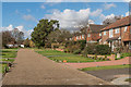
South Close Green
1950s/early 1960s housing off London Road South.
Image: © Ian Capper
Taken: 24 Feb 2017
0.07 miles
2
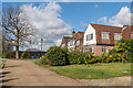
Bushetts Grove
1950s/early 1960s housing off London Road South. The name refers to a small area of woodland nearby, The Bushetts.
Image: © Ian Capper
Taken: 24 Feb 2017
0.07 miles
3
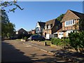
Grange Drive, Merstham
Ribbon development with a difference along the A23 southwest of Merstham; Grange Drive runs parallel to the main road, separated by a hedge with trees, and making life more tolerable for these detached houses.
Image: © Derek Harper
Taken: 15 Oct 2011
0.10 miles
4
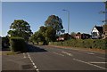
London Road South, Merstham
The A23 southwest of Merstham, with residential roads running parallel on both side. The faux-timbered gable on the right appears in Image
Image: © Derek Harper
Taken: 15 Oct 2011
0.12 miles
5
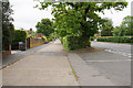
Residences off London Road South
These have their own access road screened from the main road by substantial foliage.
Image: © Bill Boaden
Taken: 17 May 2019
0.12 miles
6
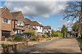
London Road South
1950s/early 1960s housing in a service road alongside London Road South.
Image: © Ian Capper
Taken: 24 Feb 2017
0.13 miles
7
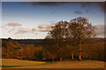
Gatton Park
An historic parkland designed by Lancelot "Capability" Brown with Edwardian gardens in Reigate. This particular view is towards Merstham.
Image: © Kurseong Carl
Taken: 16 Dec 2012
0.15 miles
8
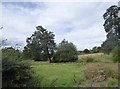
Countryside east of Rocky Lane
Photo taken from a field entrance opposite the entrance to East Lodge Farm. This patch of land seems to be pasture, left ungrazed for a while.
Image: © Stefan Czapski
Taken: 24 Aug 2018
0.17 miles
9
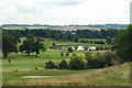
Reigate Hill Golf Club, Surrey
Looking in the direction of Nutfield. The scar just below the skyline, in the centre of picture, marks the quarrying activities for Fuller's Earth (until 2000).
Image: © Peter Trimming
Taken: 13 Aug 2009
0.17 miles