
IMAGES TAKEN NEAR TO
Rockshaw Road, REDHILL, RH1 3BZ
Introduction
This page details the photographs taken nearby to Rockshaw Road, RH1 3BZ by members of the Geograph project.
The Geograph project started in 2005 with the aim of publishing, organising and preserving representative images for every square kilometre of Great Britain, Ireland and the Isle of Man.

There are currently over 7.5m images from over14,400 individuals and you can help contribute to the project by visiting https://www.geograph.org.uk
Image Map
Images are licensed for reuse under creativecommons.org/licenses/by-sa/2.0
Notes
- Clicking on the map will re-center to the selected point.
- The higher the marker number, the further away the image location is from the centre of the postcode.
Image Listing (50 Images Found)
Images are licensed for reuse under creativecommons.org/licenses/by-sa/2.0
Image
Details
Distance
1

View Towards Rockshaw Lane, Merstham, Surrey
Looking across the flat, foreground, field, and up the bank, towards the houses which are located on Rockshaw Lane.
Image: © Peter Trimming
Taken: 7 Jan 2010
0.08 miles
2
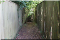
Footpath in Merstham
Linking Rockshaw Road and Brook Road.
Image: © Bill Boaden
Taken: 16 May 2019
0.09 miles
3
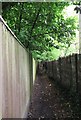
Tandridge Border Path to Furzefield Wood
This fenced path leads from Rockshaw Road to a footbridge over the M25 motorway (near Merstham) and a wood beside the motorway.
Image: © David Anstiss
Taken: 16 May 2012
0.10 miles
4

Rockshaw Road
Looking along Rockshaw Road. The house on the right is Little Shaw, designed by M H Baillie Scott and completed in 1910. Grade II listed - see https://historicengland.org.uk/listing/the-list/list-entry/1268495?section=official-list-entry.
Image: © Ian Capper
Taken: 28 Jul 2018
0.10 miles
5
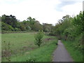
Tandridge Border Path to Furzefield Wood (2)
This path leads from Rockshaw Road to a footbridge over the M25 motorway (near Merstham) and a wood beside the motorway.
Seems quite tranquil. But the M25 traffic can be heard roaring beyond the trees.
Image: © David Anstiss
Taken: 16 May 2012
0.11 miles
6
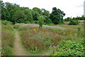
Waste land north of M25, Merstham
The public footpath to Rockshaw Road heads left, an unofficial path to nowhere in particular heads right.
Image: © Robin Webster
Taken: 5 Aug 2010
0.11 miles
7
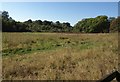
Meadow near Merstham
The meadow is beside the bridleway (97) shown in Image and Image Towards the far corner is a denehole http://www.kurg.org.uk/sites/deneholes.htm .
Image: © Derek Harper
Taken: 15 Oct 2011
0.13 miles
8
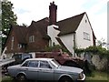
Did not know Merstham was so rough!
This cottage (with Volvo, 4x4 and Armoured Personnel Carrier) is on Rockshaw Road.
Image: © David Anstiss
Taken: 16 May 2012
0.14 miles
9

Field at Quarry Dean Farm
Field on the former Quarry Dean Farm, demolished in 1972 when the M23 was built. In the right foreground is a capped shaft into the former Quarry Dean Firestone Mine.
Image: © Ian Capper
Taken: 28 Jul 2018
0.14 miles
10
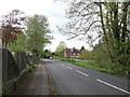
North Downs Way on Rockshaw Road
The long distance path heads along the road towards Gatton Bottom, Merstham.
The Tandridge Border Path (a less used long distance path) also follows the road for a short section.
Image: © David Anstiss
Taken: 16 May 2012
0.14 miles