IMAGES TAKEN NEAR TO
Quarry Way, HORSHAM, RH13 9SU
Introduction
This page details the photographs taken nearby to Quarry Way, RH13 9SU by members of the Geograph project.
The Geograph project started in 2005 with the aim of publishing, organising and preserving representative images for every square kilometre of Great Britain, Ireland and the Isle of Man.

There are currently over 7.5m images from over14,400 individuals and you can help contribute to the project by visiting https://www.geograph.org.uk
Image Map
Images are licensed for reuse under creativecommons.org/licenses/by-sa/2.0
Notes
- Clicking on the map will re-center to the selected point.
- The higher the marker number, the further away the image location is from the centre of the postcode.
Image Listing (38 Images Found)
Images are licensed for reuse under creativecommons.org/licenses/by-sa/2.0
Image
Details
Distance
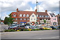
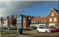
2
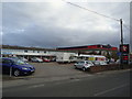
Godfreys of Horsham, Worthing Road, Southwater
Image: © Stacey Harris
Taken: 26 Nov 2011
0.11 miles
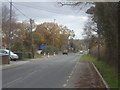
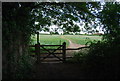
3
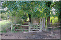
Gate on Downs Link
The trail has crossed a field where the course of the old railway normally followed has been obliterated. Here is returns to the old railway route, albeit at reduced width through the outskirts of Southwater.
Image: © Robin Webster
Taken: 22 Oct 2010
0.14 miles