IMAGES TAKEN NEAR TO
Courtlands, HORSHAM, RH13 9AD
Introduction
This page details the photographs taken nearby to Courtlands, RH13 9AD by members of the Geograph project.
The Geograph project started in 2005 with the aim of publishing, organising and preserving representative images for every square kilometre of Great Britain, Ireland and the Isle of Man.

There are currently over 7.5m images from over14,400 individuals and you can help contribute to the project by visiting https://www.geograph.org.uk
Image Map
Images are licensed for reuse under creativecommons.org/licenses/by-sa/2.0
Notes
- Clicking on the map will re-center to the selected point.
- The higher the marker number, the further away the image location is from the centre of the postcode.
Image Listing (13 Images Found)
Images are licensed for reuse under creativecommons.org/licenses/by-sa/2.0
Image
Details
Distance
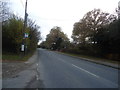
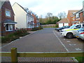
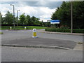
3
Worthing Road
Looking northwards on the Worthing Road at Southwater.
Image: © Chris Thomas-Atkin
Taken: 26 Apr 2021
0.07 miles
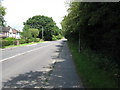
4
Bus stop at Warnham Gate on Worthing Road
The bus stop sign has been moved since http://www.geograph.org.uk/photo/2709780.
Image: © Shazz
Taken: 3 Mar 2016
0.07 miles
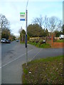
5
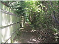
Fenced footpath at the north end of Southwater
Image: © Dave Spicer
Taken: 25 Jul 2009
0.10 miles
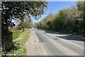
7
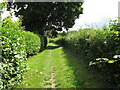
Well maintained path at rear of properties in Southwater
Image: © Dave Spicer
Taken: 25 Jul 2009
0.13 miles
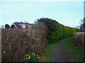
10
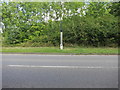
Southwater. 38 miles from London
Milestone on entrance to Southwater.
Image: © The Saunterer
Taken: 14 Sep 2012
0.21 miles