
IMAGES TAKEN NEAR TO
The Meadows, HORSHAM, RH13 9AB
Introduction
This page details the photographs taken nearby to The Meadows, RH13 9AB by members of the Geograph project.
The Geograph project started in 2005 with the aim of publishing, organising and preserving representative images for every square kilometre of Great Britain, Ireland and the Isle of Man.

There are currently over 7.5m images from over14,400 individuals and you can help contribute to the project by visiting https://www.geograph.org.uk
Image Map
Images are licensed for reuse under creativecommons.org/licenses/by-sa/2.0
Notes
- Clicking on the map will re-center to the selected point.
- The higher the marker number, the further away the image location is from the centre of the postcode.
Image Listing (16 Images Found)
Images are licensed for reuse under creativecommons.org/licenses/by-sa/2.0
Image
Details
Distance
2
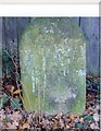
Old Milestone by the former A24, Mill Straight, Southwater parish
Carved stone post by the UC road (was A24), in parish of SOUTHWATER (HORSHAM District), Mill Straight, West of Fieldings, against fence, on South side of road at end of bus layby. Steyning stone, erected by the Horsham & Steyning turnpike trust in the 19th century.
Inscription reads:-
40
MILES
FROM
LONDON
Carved benchmark upper centre, rivet on top.
West Sussex HER.
HER Ref: MWS8538 https://www.heritagegateway.org.uk/Gateway/Results_Single.aspx?uid=MWS8538&resourceID=1032
Milestone Society National ID: SX_LA40.
Image: © C Woodward
Taken: 14 Oct 2010
0.09 miles
3
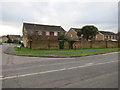
Post Box
RH13 101 Cripplegate Lane (Southwater)
Image: © The Saunterer
Taken: 13 Jan 2013
0.09 miles
4
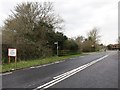
Public Footpath
FP1688 off Mill Straight
Image: © The Saunterer
Taken: 13 Jan 2013
0.13 miles
5
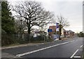
Public Bridleway
BW3573 junction with Mill Straight
Image: © The Saunterer
Taken: 13 Jan 2013
0.14 miles
6
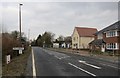
Entry to Southwater
Harvest Meadows a new housing development on the right of Mill Straight
Image: © The Saunterer
Taken: 13 Jan 2013
0.14 miles
7
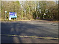
Entrance to Southwater Country Park
This is at the northern end of Andrews Road.
Image: © Shazz
Taken: 11 Dec 2016
0.17 miles
9
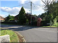
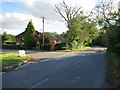
K6 Phone Box
Corner of Shipley Road and Foxfield Cottages.
Image: © The Saunterer
Taken: 14 Oct 2012
0.18 miles
10
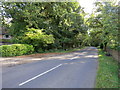
Public Footpath FP1688
Off Shipley Road
Image: © The Saunterer
Taken: 14 Oct 2012
0.19 miles