
IMAGES TAKEN NEAR TO
Tideys Mill, HORSHAM, RH13 8WD
Introduction
This page details the photographs taken nearby to Tideys Mill, RH13 8WD by members of the Geograph project.
The Geograph project started in 2005 with the aim of publishing, organising and preserving representative images for every square kilometre of Great Britain, Ireland and the Isle of Man.

There are currently over 7.5m images from over14,400 individuals and you can help contribute to the project by visiting https://www.geograph.org.uk
Image Map
Images are licensed for reuse under creativecommons.org/licenses/by-sa/2.0
Notes
- Clicking on the map will re-center to the selected point.
- The higher the marker number, the further away the image location is from the centre of the postcode.
Image Listing (194 Images Found)
Images are licensed for reuse under creativecommons.org/licenses/by-sa/2.0
Image
Details
Distance
1

Tidey's Mill, Partridge Green
A small cul de sac off High Street that was built around 1989-90 on the site of a former steam mill. The mill was built around 1862 and remained in operation until closing in 1970. The former mill was used as a depot and storage facility until demolished in the 1980s to make way for the current development. All that survives of the former mill is its pond which is beyond the parked cars on the right.
Image: © Simon Carey
Taken: 31 Jul 2016
0.00 miles
2

Car Park, Partridge Green
The main village car park which is located off Village Hall Lane next to the village hall and opposite a doctor's surgery.
Image: © Simon Carey
Taken: 31 Jul 2016
0.01 miles
3
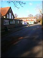
Partridge Green Village Hall
Tucked away behind the High Street next to the village's car park. The houses beyond are the rear of those in Little Oak.
Image: © Simon Carey
Taken: 22 Nov 2008
0.01 miles

5

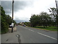
Morningside, High Street, Partridge Green
A semi-detached pair of cottages built between the wars. Beyond to the right is Image
Image: © Simon Carey
Taken: 31 Jul 2016
0.02 miles
7
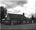
Village Hall, Partridge Green
Built in 1904 and extended in 1975. Located on Image just to the north of High Street.
Image: © Simon Carey
Taken: 31 Jul 2016
0.03 miles
8

Woodcot, High Street, Partridge Green
A small block of flats which i think were built towards the end of the 1990s on the site of the gardens and old house of the same name.
Image: © Simon Carey
Taken: 31 Jul 2016
0.03 miles
10
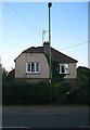
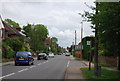
Alma Villa, High Street, Partridge Green
Built after the Second World War and currently adjacent to the entrance to Huffwood Trading Estate.
Image: © Simon Carey
Taken: 6 Aug 2016
0.04 miles