IMAGES TAKEN NEAR TO
Thakeham Road, HORSHAM, RH13 8QD
Introduction
This page details the photographs taken nearby to Thakeham Road, RH13 8QD by members of the Geograph project.
The Geograph project started in 2005 with the aim of publishing, organising and preserving representative images for every square kilometre of Great Britain, Ireland and the Isle of Man.

There are currently over 7.5m images from over14,400 individuals and you can help contribute to the project by visiting https://www.geograph.org.uk
Image Map
Images are licensed for reuse under creativecommons.org/licenses/by-sa/2.0
Notes
- Clicking on the map will re-center to the selected point.
- The higher the marker number, the further away the image location is from the centre of the postcode.
Image Listing (30 Images Found)
Images are licensed for reuse under creativecommons.org/licenses/by-sa/2.0
Image
Details
Distance
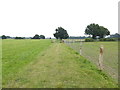
1
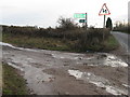
Entrance to Public Footpath FP1965
Off Public Bridleway BW1966
Image: © The Saunterer
Taken: 24 Feb 2013
0.09 miles
2
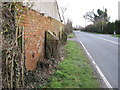
Wall buttresses suffering from subsidence
On building near D-Day airfield
Image: © Dave Spicer
Taken: 31 Jan 2010
0.11 miles
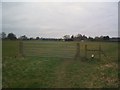
3
Footpath and bridleway junction east of the B2139
See also http://www.geograph.org.uk/photo/3345658.
Image: © Shazz
Taken: 18 Aug 2016
0.11 miles
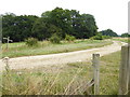
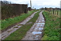
4
Bridleway entrance to the D-Day ALG airfield
Image: © Dave Spicer
Taken: 31 Jan 2010
0.11 miles
5
Track to site of Coolham Advanced Landing Ground
Image: © David Martin
Taken: 29 Jan 2018
0.11 miles
6
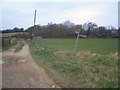
Path Junction
Public Bridleway BW1966 and Public Footpath FP1965
Image: © The Saunterer
Taken: 24 Feb 2013
0.12 miles
7
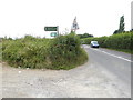
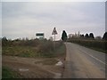
Signpost to Coolham ALG on the B2139
ALG, I have learned, stands for Advance Landing Ground. This airfield was used on D Day. See http://www.geograph.org.uk/photo/5080159 for local memorial.
See also http://www.geograph.org.uk/photo/2345040.
Image: © Shazz
Taken: 18 Aug 2016
0.12 miles
8
Public Bridleway BW1966
Off Coolham Road. Entrance to Coolham ALG Airfield (now disused)
Image: © The Saunterer
Taken: 24 Feb 2013
0.13 miles
9
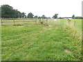
Gate on footpath near Coolham
The path from the left is not a public right of way.
Image: © Shazz
Taken: 18 Aug 2016
0.14 miles