
IMAGES TAKEN NEAR TO
Dial Post, HORSHAM, RH13 8NY
Introduction
This page details the photographs taken nearby to RH13 8NY by members of the Geograph project.
The Geograph project started in 2005 with the aim of publishing, organising and preserving representative images for every square kilometre of Great Britain, Ireland and the Isle of Man.

There are currently over 7.5m images from over14,400 individuals and you can help contribute to the project by visiting https://www.geograph.org.uk
Image Map
Images are licensed for reuse under creativecommons.org/licenses/by-sa/2.0
Notes
- Clicking on the map will re-center to the selected point.
- The higher the marker number, the further away the image location is from the centre of the postcode.
Image Listing (21 Images Found)
Images are licensed for reuse under creativecommons.org/licenses/by-sa/2.0
Image
Details
Distance
1
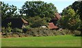
Manor Barn, Sands Lane
The main barn to Sands Farm was converted into a dwelling during the early 1990s. The smaller hovel on the left was converted into a studio in 2015.
Image: © Simon Carey
Taken: 30 Aug 2016
0.01 miles
2
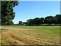
Grinders Field/The Two Acres
The name of the fields according to West Grinstead's 1841 tithe map that have been merged to form a larger unit. Grinders field was in the foreground to the west and The Two Acres in the distance to the east adjacent to Image To the north is Sands Lane.
Image: © Simon Carey
Taken: 30 Aug 2016
0.09 miles
3
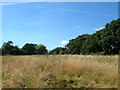
The Green
The name of the field according to West Grinstead's 1841 tithe map that has been merged with Image to the east to form a larger unit. To the west is Sands Farm whilst to the north is the bridleway that links Dial Post to Partridge Green.
Image: © Simon Carey
Taken: 30 Aug 2016
0.09 miles
4
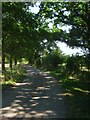
Sands Lane
The local name given to the private road and public bridleway between Grinder's Lane and Sands Farm. The bridleway itself links Dial Post to Partridge Green but not for vehicles.
Image: © Simon Carey
Taken: 30 Aug 2016
0.11 miles
5
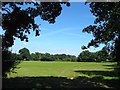
Grinders Five Acres
The name of the field according to West Grinstead's 1841 tithe map that is bounded by Sands Lane to the south and Image to the east.
Image: © Simon Carey
Taken: 30 Aug 2016
0.14 miles
6
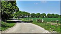
Northbound track to the east of Thistleworth Farm
Image: © Ian Hawfinch
Taken: 24 Apr 2020
0.15 miles
7
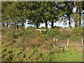
Footpath junction
FP1865 and Bridleway BW1864
Image: © The Saunterer
Taken: 2 Nov 2012
0.15 miles
8
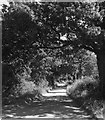
Sands Lane
The local name given to the section of a private drive and public bridleway that runs east from Grinder's Lane as far as Sands Farm. The bridleway itself links Dial Post to Partridge Green but not as a through route for vehicles.
Image: © Simon Carey
Taken: 30 Aug 2016
0.18 miles
9
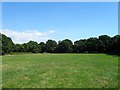
Five Acres
The name of the field according to West Grinstead's 1841 tithe map that has been merged with Image to the west to form a larger unit. To the south is Image, to the north is Image and to the east is Image The old boundary between the two follows the course of the public footpath.
Image: © Simon Carey
Taken: 30 Aug 2016
0.19 miles
10
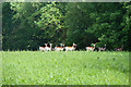
Fallow deer near Soil Gill
Originally rather further out in the field, they rather reluctantly moved into the wood as a walker invaded their privacy.
Image: © Robin Webster
Taken: 21 May 2011
0.20 miles