
IMAGES TAKEN NEAR TO
Bentons Lane, HORSHAM, RH13 8NW
Introduction
This page details the photographs taken nearby to Bentons Lane, RH13 8NW by members of the Geograph project.
The Geograph project started in 2005 with the aim of publishing, organising and preserving representative images for every square kilometre of Great Britain, Ireland and the Isle of Man.

There are currently over 7.5m images from over14,400 individuals and you can help contribute to the project by visiting https://www.geograph.org.uk
Image Map
Images are licensed for reuse under creativecommons.org/licenses/by-sa/2.0
Notes
- Clicking on the map will re-center to the selected point.
- The higher the marker number, the further away the image location is from the centre of the postcode.
Image Listing (56 Images Found)
Images are licensed for reuse under creativecommons.org/licenses/by-sa/2.0
Image
Details
Distance
1

Bentons Lane, Dial Post
Small residential lane that provides access to Bentons Place Farm less than a mile to the west. The houses on the right are Tierney and Highgrove.
Image: © Simon Carey
Taken: 23 Jul 2016
0.02 miles
2
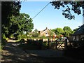
Bentons Lane, Dial Post
A private lane and public bridleway that heads west to Bentons Place. The houses in view are Beehive to the right and Oaklands beyond both of which were built between the wars on a former field called Eleven Acres according to West Grinstead's 1841 tithe map.
Image: © Simon Carey
Taken: 26 Aug 2016
0.05 miles
3
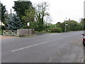
Bridleway BW 1886/1
Off Worthing Road.
Image: © The Saunterer
Taken: 21 Oct 2012
0.08 miles
4
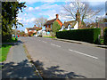
Worthing Road, Dial Post
Hard to believe that the A24 used to thunder through this village until the 1980s. Now all is quiet and serene. Dial Post is a hamlet within the parish of West Grinstead and grew in size from the eighteenth century onwards. The in is The Crown.
Image: © Simon Carey
Taken: 9 Apr 2006
0.08 miles
5

Orchard Field
The name of the field according to West Grinstead's 1841 tithe map that is bounded by Image and Image to the west. Not much of the original field remains, just a section to the north west with the rest now developed with housing. Knepp Cottage is visible on the left.
Image: © Simon Carey
Taken: 23 Jul 2016
0.08 miles
6
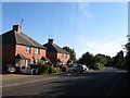
Dial Post Cottages, Worthing Road, Dial Post
A pair of semi-detached cottages built sometime between the wars.
Image: © Simon Carey
Taken: 26 Aug 2016
0.09 miles
7
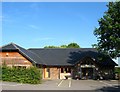
Village Hall, Worthing Road, Dial Post
Opened in 2011 to replace an older hall and located at the southern end of the settlement.
Image: © Simon Carey
Taken: 26 Aug 2016
0.09 miles
8

1-2, Dial Post Cottages, Worthing Road, Dial Post
One of a pair of semi-detached cottages that were not marked on the 1911 OS map but do appear in a 1946 aerial photograph. Beyond is Image
Image: © Simon Carey
Taken: 23 Jul 2016
0.10 miles
9

Former Works, Worthing Road, Dial Post
An engineering works had existed here since the 1920s and were formerly home to Blaker Welding Ltd who moved over to Adversane near Billingshurst a few years ago. At the time of writing there is a planning application to remove some of the former workspace to build housing and retain another to convert into offices.
Image: © Simon Carey
Taken: 23 Jul 2016
0.10 miles
10

Little Plat
The name of the field according to West Grinstead's 1841 tithe map that has been merged with Image to the north to form a larger unit. It is bounded to the south by Image and east by Image At the far end is a small sewage works.
Image: © Simon Carey
Taken: 23 Jul 2016
0.10 miles