IMAGES TAKEN NEAR TO
Park Lane, HORSHAM, RH13 8LT
Introduction
This page details the photographs taken nearby to Park Lane, RH13 8LT by members of the Geograph project.
The Geograph project started in 2005 with the aim of publishing, organising and preserving representative images for every square kilometre of Great Britain, Ireland and the Isle of Man.

There are currently over 7.5m images from over14,400 individuals and you can help contribute to the project by visiting https://www.geograph.org.uk
Image Map (Loading...)


Getting Data...Please wait
Leaflet Map data © OpenStreetMap
Images are licensed for reuse under creativecommons.org/licenses/by-sa/2.0
Notes
- Clicking on the map will re-center to the selected point.
- The higher the marker number, the further away the image location is from the centre of the postcode.
Image Listing (55 Images Found)
Images are licensed for reuse under creativecommons.org/licenses/by-sa/2.0
Image
Details
Distance
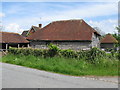
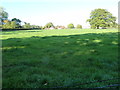
2
Griffin's Farm Buildings
From the Downs Link. Conifers on Pope's Oak Farm just visible over roofs.
Image: © The Saunterer
Taken: 25 May 2012
0.01 miles
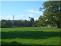
3
Griffin's Farm Buildings
Griffin's Farm buildings from Footpath 1832.
Image: © The Saunterer
Taken: 12 May 2012
0.02 miles
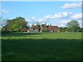
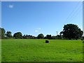
4
Griffin's Farm
Griffin's Farm from Footpath 1832.
Image: © The Saunterer
Taken: 11 May 2012
0.02 miles
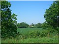
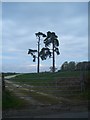
6
The Conifers
Another view of the conifers On Pope's Oak Farm with The Coppice in the background. Photo taken from Footpath 1832 across Griffin's Farm and Park Lane.
Image: © The Saunterer
Taken: 11 May 2012
0.05 miles
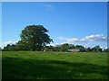
7
House Meadow
The name of the field according to West Grinstead's 1841 tithe map. To the west is Park Lane, to the north is Griffin's Farm whilst to the south is Image
Image: © Simon Carey
Taken: 9 Aug 2016
0.06 miles
8
Conifers
Conifers opposite Griffin's Farm in Park Lane. Another view of the same trees as previously photographed on 9th May 2009. Some branches were lost in a storm earlier in 2012.
Image: © The Saunterer
Taken: 24 Apr 2012
0.08 miles
9
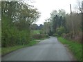
Park Lane
Park Lane West Grinstead looking south towards the nasty corner. Spire of Our Lady of Consolation Catholic church can be seen in the background.
Image: © The Saunterer
Taken: 24 Apr 2012
0.09 miles
10
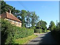
46, Park Lane, West Grinstead
The current cottage dates from the early 1960s and was built on the site of a pair of older semi-detached cottages. The number is for the estate not the road.
Image: © Simon Carey
Taken: 9 Aug 2016
0.10 miles