IMAGES TAKEN NEAR TO
Station Road, HORSHAM, RH13 8DD
Introduction
This page details the photographs taken nearby to Station Road, RH13 8DD by members of the Geograph project.
The Geograph project started in 2005 with the aim of publishing, organising and preserving representative images for every square kilometre of Great Britain, Ireland and the Isle of Man.

There are currently over 7.5m images from over14,400 individuals and you can help contribute to the project by visiting https://www.geograph.org.uk
Image Map (Loading...)


Getting Data...Please wait
Leaflet Map data © OpenStreetMap
Images are licensed for reuse under creativecommons.org/licenses/by-sa/2.0
Notes
- Clicking on the map will re-center to the selected point.
- The higher the marker number, the further away the image location is from the centre of the postcode.
Image Listing (24 Images Found)
Images are licensed for reuse under creativecommons.org/licenses/by-sa/2.0
Image
Details
Distance
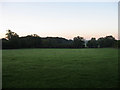
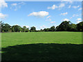
3
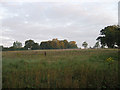
Great Meadow
The name of the field according to the 1840 tithe map with the hedgerow at the far end catching the first sunlight of the day.
Image: © Simon Carey
Taken: 28 Aug 2010
0.09 miles
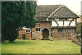
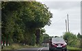
4
Barn, Capon's Farm
Looking along Brownings Hill, the A272, at one of the barns that lie at the entrance of Capon's Farm. The building is catching the early morning sun.
Image: © Simon Carey
Taken: 28 Aug 2010
0.09 miles
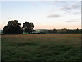
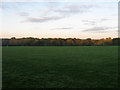
5
Little Meadow
The name of the field according to the 1840 tithe map viewed ten minutes after sunrise.
Image: © Simon Carey
Taken: 28 Aug 2010
0.10 miles
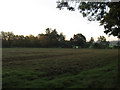
6
West Mead
The name of the field according to the 1840 tithe map taken ten minutes after sunrise.
Image: © Simon Carey
Taken: 28 Aug 2010
0.12 miles
7
North Coppice
The name of the field according to the 1840 tithe map that belies its origins as a small wood.
Image: © Simon Carey
Taken: 28 Aug 2010
0.13 miles
9
Barn Field
The name of the field according to the 1840 tithe map viewed from the footpath that links Gervaise Cottage with St Peter's church.
Image: © Simon Carey
Taken: 28 Aug 2010
0.17 miles
10
Stone Field/Spring Field
The name of the fields according to the 1840 tithe map that have been joined together. Brownings Gill is the wood at the far end of the field.
Image: © Simon Carey
Taken: 28 Aug 2010
0.18 miles