IMAGES TAKEN NEAR TO
Thornden, HORSHAM, RH13 8AG
Introduction
This page details the photographs taken nearby to Thornden, RH13 8AG by members of the Geograph project.
The Geograph project started in 2005 with the aim of publishing, organising and preserving representative images for every square kilometre of Great Britain, Ireland and the Isle of Man.

There are currently over 7.5m images from over14,400 individuals and you can help contribute to the project by visiting https://www.geograph.org.uk
Image Map
Images are licensed for reuse under creativecommons.org/licenses/by-sa/2.0
Notes
- Clicking on the map will re-center to the selected point.
- The higher the marker number, the further away the image location is from the centre of the postcode.
Image Listing (192 Images Found)
Images are licensed for reuse under creativecommons.org/licenses/by-sa/2.0
Image
Details
Distance
3
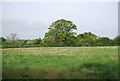
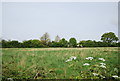
Parsonage Field
The name of the field according to the 1840 tithe map. The old parsonage lay to the east of the field now covered by a small housing estate. Brownings Hill, the A272, is at the bottom of the field.
Image: © Simon Carey
Taken: 24 Aug 2010
0.09 miles
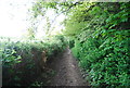
5
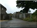
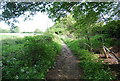
Public footpath through housing estate, Cowfold
Image: © David Smith
Taken: 5 Sep 2024
0.10 miles
8
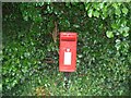
Post Box
Post Box RH13 214. Tower Hill. Horsham.
Image: © The Saunterer
Taken: 18 Jul 2012
0.10 miles
10
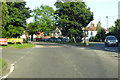
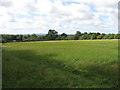
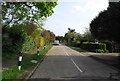
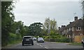
A272 entering Cowfold from the west
The A272 has a joggled crossing with the A281 in the village.
Image: © Robin Webster
Taken: 27 Jun 2019
0.11 miles