IMAGES TAKEN NEAR TO
Blatchford Road, HORSHAM, RH13 5QR
Introduction
This page details the photographs taken nearby to Blatchford Road, RH13 5QR by members of the Geograph project.
The Geograph project started in 2005 with the aim of publishing, organising and preserving representative images for every square kilometre of Great Britain, Ireland and the Isle of Man.

There are currently over 7.5m images from over14,400 individuals and you can help contribute to the project by visiting https://www.geograph.org.uk
Image Map (Loading...)


Getting Data...Please wait
Leaflet Map data © OpenStreetMap
Images are licensed for reuse under creativecommons.org/licenses/by-sa/2.0
Notes
- Clicking on the map will re-center to the selected point.
- The higher the marker number, the further away the image location is from the centre of the postcode.
Image Listing (24 Images Found)
Images are licensed for reuse under creativecommons.org/licenses/by-sa/2.0
Image
Details
Distance
1
Industrial Estate by Redkiln Way Horsham
Image: © Dave Spicer
Taken: 15 Jul 2012
0.09 miles
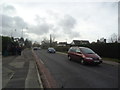
5
Bunting Close at the junction of Harwood Road
Image: © David Howard
Taken: 30 Jan 2017
0.14 miles
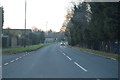
6
Kings Road Roundabout bus stop
For routes 23 and 98 towards Horsham town centre. Oddly, in both directions there are bus shelters close to the roundabout but a fair step from the posted stops.
Image: © Robin Webster
Taken: 18 Apr 2018
0.14 miles
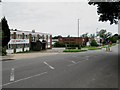
7
Kings Road, Horsham
Towards the town centre.
Image: © Robin Webster
Taken: 18 Apr 2018
0.14 miles