IMAGES TAKEN NEAR TO
Bashurst Hill, HORSHAM, RH13 0TF
Introduction
This page details the photographs taken nearby to Bashurst Hill, RH13 0TF by members of the Geograph project.
The Geograph project started in 2005 with the aim of publishing, organising and preserving representative images for every square kilometre of Great Britain, Ireland and the Isle of Man.

There are currently over 7.5m images from over14,400 individuals and you can help contribute to the project by visiting https://www.geograph.org.uk
Image Map
Images are licensed for reuse under creativecommons.org/licenses/by-sa/2.0
Notes
- Clicking on the map will re-center to the selected point.
- The higher the marker number, the further away the image location is from the centre of the postcode.
Image Listing (16 Images Found)
Images are licensed for reuse under creativecommons.org/licenses/by-sa/2.0
Image
Details
Distance
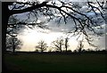
1
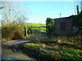
Waterworks building and reservoir on Bashurst Hill
Image: © Shazz
Taken: 2 Feb 2016
0.03 miles
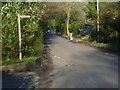
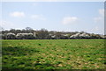
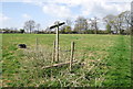
3
Covered Reservoir
The covered reservoir at Bashurst Hill.
Image: © Chris Thomas-Atkin
Taken: 26 Apr 2021
0.09 miles
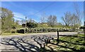
6
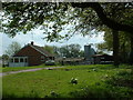
Poultry sheds and Silos
Just south of Bashurst Reservoir
Image: © Chris Shaw
Taken: 7 May 2006
0.16 miles
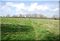
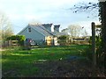
10
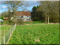
Dwelling at Lower Toat Farm
The other side of this building is seen at http://www.geograph.org.uk/photo/2968723.
Image: © Shazz
Taken: 2 Feb 2016
0.23 miles