IMAGES TAKEN NEAR TO
Guildford Road, HORSHAM, RH13 0RA
Introduction
This page details the photographs taken nearby to Guildford Road, RH13 0RA by members of the Geograph project.
The Geograph project started in 2005 with the aim of publishing, organising and preserving representative images for every square kilometre of Great Britain, Ireland and the Isle of Man.

There are currently over 7.5m images from over14,400 individuals and you can help contribute to the project by visiting https://www.geograph.org.uk
Image Map (Loading...)


Getting Data...Please wait
Leaflet Map data © OpenStreetMap
Images are licensed for reuse under creativecommons.org/licenses/by-sa/2.0
Notes
- Clicking on the map will re-center to the selected point.
- The higher the marker number, the further away the image location is from the centre of the postcode.
Image Listing (22 Images Found)
Images are licensed for reuse under creativecommons.org/licenses/by-sa/2.0
Image
Details
Distance
1
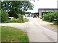
By Dedisham
The bridleway here has a good surface, it uses the farm road to Dedisham.
Image: © Colin Smith
Taken: 20 Jun 2009
0.03 miles
3
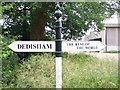
Odd but True
Whimsical signpost at Dedisham Farm in the West Sussex Weald near Slinfold.
Image: © Colin Smith
Taken: 20 Jun 2009
0.05 miles
5
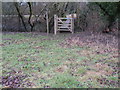
Gate and footbridge over small tributary of the River Arun
This short footpath near Dedisham is not shown on the Landranger map but is on the Explorer
Image: © Dave Spicer
Taken: 14 Feb 2010
0.08 miles
6
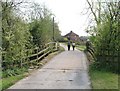
Bridge over the River Arun on Dedisham Farm
On Bridleway 1400.
Image: © Andy Potter
Taken: 18 Apr 2007
0.08 miles
7
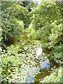
River Arun
Seen here from the bridge taking the farm traffic to Dedisham. The river is shallow, slow flowing. It hosts water lilies and grasses.
Image: © Colin Smith
Taken: 20 Jun 2009
0.08 miles
8
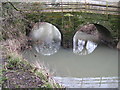
Bridge over the River Arun
This small bridge carries the service road to Dedisham and Violets Farm.
Image: © Dave Spicer
Taken: 14 Feb 2010
0.08 miles
9
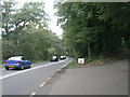
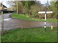
Junction of A281 and footpath leading to Furnace Lakes
The footpath follows the road to the right for about 200m, then splits into three. The middle footpath takes you up to the Furnace Lakes - a relic of the Weald's extensive iron industry. They are also the home of the Furnace Lakes Carp Fishery http://www.fisheries.co.uk/furnacelakes/index.htm
Image: © Andy Potter
Taken: 14 Sep 2006
0.12 miles
10
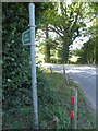
Footpath sign pointing the way to Dedisham
Image: © Basher Eyre
Taken: 18 Sep 2020
0.14 miles