IMAGES TAKEN NEAR TO
Holmbush Close, HORSHAM, RH12 5YB
Introduction
This page details the photographs taken nearby to Holmbush Close, RH12 5YB by members of the Geograph project.
The Geograph project started in 2005 with the aim of publishing, organising and preserving representative images for every square kilometre of Great Britain, Ireland and the Isle of Man.

There are currently over 7.5m images from over14,400 individuals and you can help contribute to the project by visiting https://www.geograph.org.uk
Image Map
Images are licensed for reuse under creativecommons.org/licenses/by-sa/2.0
Notes
- Clicking on the map will re-center to the selected point.
- The higher the marker number, the further away the image location is from the centre of the postcode.
Image Listing (19 Images Found)
Images are licensed for reuse under creativecommons.org/licenses/by-sa/2.0
Image
Details
Distance
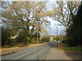
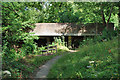
4
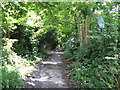
Bridleway near the centre of Horsham
The short bridleway connects Pondtail Road with North Heath Lane.
Image: © Dave Spicer
Taken: 15 Jul 2012
0.17 miles
7
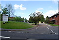
Entrance to North Heath Estate, North Heath Lane
The entrance to this industrial estate is in this square, but most of the estate is in the adjoining square.
Image: © N Chadwick
Taken: 3 May 2009
0.20 miles
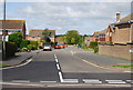
9
Cook Road bridge over Channels Brook
A linear open space follows the brook for some way through the built-up area, with paths on each side. On this bank the path passes under Cook Road beside the brook.
Image: © Robin Webster
Taken: 21 Jul 2010
0.21 miles
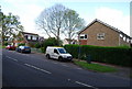
10
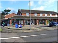
Coltsfoot Drive Shops
This set of shops were built in the 1980's for a new housing development. They now consist of a chemist, beauty therapy, dentist, cafe, newsagents with post office, Spar, Chinese Take away and hair dressers.
Image: © Julia Forbes
Taken: 7 Mar 2007
0.21 miles