IMAGES TAKEN NEAR TO
Park Farm Close, HORSHAM, RH12 5EU
Introduction
This page details the photographs taken nearby to Park Farm Close, RH12 5EU by members of the Geograph project.
The Geograph project started in 2005 with the aim of publishing, organising and preserving representative images for every square kilometre of Great Britain, Ireland and the Isle of Man.

There are currently over 7.5m images from over14,400 individuals and you can help contribute to the project by visiting https://www.geograph.org.uk
Image Map
Images are licensed for reuse under creativecommons.org/licenses/by-sa/2.0
Notes
- Clicking on the map will re-center to the selected point.
- The higher the marker number, the further away the image location is from the centre of the postcode.
Image Listing (22 Images Found)
Images are licensed for reuse under creativecommons.org/licenses/by-sa/2.0
Image
Details
Distance
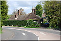
3
Pondtail Road, Littlehaven
Looking towards Horsham Bowling Club http://horsham-bowling-club.co.uk/
Image: © David Howard
Taken: 30 Jan 2017
0.12 miles


10
Roundabout, Giblets Way & North Heath Lane
Image: © N Chadwick
Taken: 3 May 2009
0.19 miles