IMAGES TAKEN NEAR TO
Crawley Road, HORSHAM, RH12 4SA
Introduction
This page details the photographs taken nearby to Crawley Road, RH12 4SA by members of the Geograph project.
The Geograph project started in 2005 with the aim of publishing, organising and preserving representative images for every square kilometre of Great Britain, Ireland and the Isle of Man.

There are currently over 7.5m images from over14,400 individuals and you can help contribute to the project by visiting https://www.geograph.org.uk
Image Map (Loading...)


Getting Data...Please wait
Leaflet Map data © OpenStreetMap
Images are licensed for reuse under creativecommons.org/licenses/by-sa/2.0
Notes
- Clicking on the map will re-center to the selected point.
- The higher the marker number, the further away the image location is from the centre of the postcode.
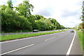
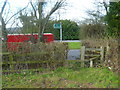
Image Listing (25 Images Found)
Images are licensed for reuse under creativecommons.org/licenses/by-sa/2.0
Image
Details
Distance
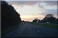
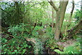
2
Exploring eastwards along the Bashire (31)
Access road from The Cherry Tree to Little Clovers Farm; and then the A264
Image: © Basher Eyre
Taken: 7 Oct 2020
0.03 miles
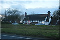
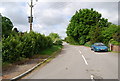
4
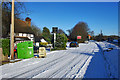
A snowy A264 Cherry Tree layby
This appears to be the old road alignment after the A264 was upgraded. Not strictly a layby - really access to the pub and few houses.
Image: © Robin Webster
Taken: 20 Dec 2009
0.07 miles