IMAGES TAKEN NEAR TO
Newdigate Road, HORSHAM, RH12 4RP
Introduction
This page details the photographs taken nearby to Newdigate Road, RH12 4RP by members of the Geograph project.
The Geograph project started in 2005 with the aim of publishing, organising and preserving representative images for every square kilometre of Great Britain, Ireland and the Isle of Man.

There are currently over 7.5m images from over14,400 individuals and you can help contribute to the project by visiting https://www.geograph.org.uk
Image Map
Images are licensed for reuse under creativecommons.org/licenses/by-sa/2.0
Notes
- Clicking on the map will re-center to the selected point.
- The higher the marker number, the further away the image location is from the centre of the postcode.
Image Listing (17 Images Found)
Images are licensed for reuse under creativecommons.org/licenses/by-sa/2.0
Image
Details
Distance
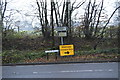
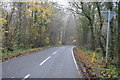
3
Junction of Partridge Lane and Rusper Road, Near Rusper, West Sussex.
NB. This junction is just into Surrey.
The roads at this junction lead to Charlwood (Surrey), Newdigate (Surrey) and Rusper (West Sussex).
Image: © Pete Chapman
Taken: 14 Jul 2005
0.15 miles
8
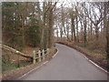
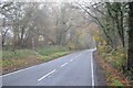
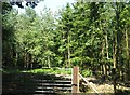
Partridge Lane
Jordans wood is on the left
Image: © David Howard
Taken: 30 Jan 2012
0.17 miles
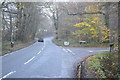
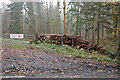
9
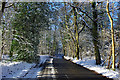
Partridge Lane
Just before its junction with Rusper Road, on a cold and sunny winter's day.
Image: © Robin Webster
Taken: 20 Dec 2009
0.18 miles