IMAGES TAKEN NEAR TO
Lambs Farm Road, HORSHAM, RH12 4DW
Introduction
This page details the photographs taken nearby to Lambs Farm Road, RH12 4DW by members of the Geograph project.
The Geograph project started in 2005 with the aim of publishing, organising and preserving representative images for every square kilometre of Great Britain, Ireland and the Isle of Man.

There are currently over 7.5m images from over14,400 individuals and you can help contribute to the project by visiting https://www.geograph.org.uk
Image Map
Images are licensed for reuse under creativecommons.org/licenses/by-sa/2.0
Notes
- Clicking on the map will re-center to the selected point.
- The higher the marker number, the further away the image location is from the centre of the postcode.
Image Listing (25 Images Found)
Images are licensed for reuse under creativecommons.org/licenses/by-sa/2.0
Image
Details
Distance
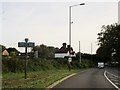
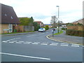
1
Looking across the B2195 from footpath by public house
Image: © Shazz
Taken: 25 Feb 2016
0.08 miles
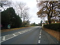
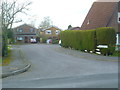
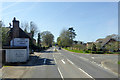
3
Looking into White Horse Road
The road is shown as Whitehorse Road on OS mapping.
Image: © Shazz
Taken: 25 Feb 2016
0.10 miles
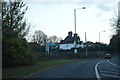
5
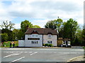
The Norfolk Arms in Crawley Road Horsham
Image: © Rod Allday
Taken: 16 Apr 2017
0.10 miles
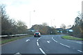
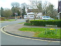
6
Crawley Road, Roffey, at the Norfolk Arms
Heading into Horsham.
Image: © Robin Webster
Taken: 18 Apr 2018
0.10 miles