IMAGES TAKEN NEAR TO
Cedar Close, HORSHAM, RH12 2BN
Introduction
This page details the photographs taken nearby to Cedar Close, RH12 2BN by members of the Geograph project.
The Geograph project started in 2005 with the aim of publishing, organising and preserving representative images for every square kilometre of Great Britain, Ireland and the Isle of Man.

There are currently over 7.5m images from over14,400 individuals and you can help contribute to the project by visiting https://www.geograph.org.uk
Image Map
Images are licensed for reuse under creativecommons.org/licenses/by-sa/2.0
Notes
- Clicking on the map will re-center to the selected point.
- The higher the marker number, the further away the image location is from the centre of the postcode.
Image Listing (199 Images Found)
Images are licensed for reuse under creativecommons.org/licenses/by-sa/2.0
Image
Details
Distance
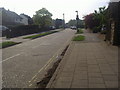
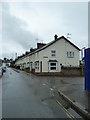
1
Blunts Way at junction of North Parade
Image: © David Howard
Taken: 24 Apr 2011
0.09 miles
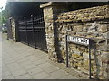
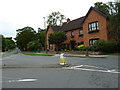
3
Junction of Springfield Road with Potter's Place
Image: © Basher Eyre
Taken: 22 Aug 2010
0.09 miles
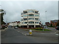
4
Junction of London Road and North Parade
Image: © Basher Eyre
Taken: 22 Aug 2010
0.09 miles
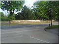
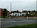
6
Approaching the junction of Trafalgar Road and Rushmans Road
Image: © Basher Eyre
Taken: 22 Aug 2010
0.09 miles
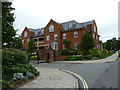
7
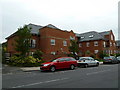
Impressive building in Springfield Road
Image: © Basher Eyre
Taken: 22 Aug 2010
0.10 miles