IMAGES TAKEN NEAR TO
Ridgehurst Drive, HORSHAM, RH12 1XF
Introduction
This page details the photographs taken nearby to Ridgehurst Drive, RH12 1XF by members of the Geograph project.
The Geograph project started in 2005 with the aim of publishing, organising and preserving representative images for every square kilometre of Great Britain, Ireland and the Isle of Man.

There are currently over 7.5m images from over14,400 individuals and you can help contribute to the project by visiting https://www.geograph.org.uk
Image Map
Images are licensed for reuse under creativecommons.org/licenses/by-sa/2.0
Notes
- Clicking on the map will re-center to the selected point.
- The higher the marker number, the further away the image location is from the centre of the postcode.
Image Listing (54 Images Found)
Images are licensed for reuse under creativecommons.org/licenses/by-sa/2.0
Image
Details
Distance
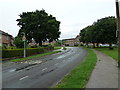
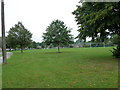
1
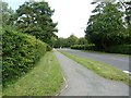
Hills Farm Road Horsham
The bridge in the distance runs over the River Arun.
Image: © Dave Spicer
Taken: 14 Sep 2011
0.11 miles
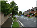
3
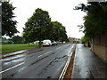
A wet August afternoon in Blackbridge Lane
Image: © Basher Eyre
Taken: 22 Aug 2010
0.12 miles
7
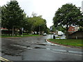
Looking across Blackbridge Lane towards Arunside
Image: © Basher Eyre
Taken: 22 Aug 2010
0.13 miles
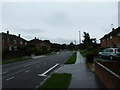
10
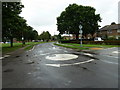
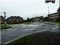
Signs of recent rain at the mini-roundabout in Blackbridge Lane
Image: © Basher Eyre
Taken: 22 Aug 2010
0.15 miles