IMAGES TAKEN NEAR TO
Alder Copse, HORSHAM, RH12 1LD
Introduction
This page details the photographs taken nearby to Alder Copse, RH12 1LD by members of the Geograph project.
The Geograph project started in 2005 with the aim of publishing, organising and preserving representative images for every square kilometre of Great Britain, Ireland and the Isle of Man.

There are currently over 7.5m images from over14,400 individuals and you can help contribute to the project by visiting https://www.geograph.org.uk
Image Map
Images are licensed for reuse under creativecommons.org/licenses/by-sa/2.0
Notes
- Clicking on the map will re-center to the selected point.
- The higher the marker number, the further away the image location is from the centre of the postcode.
Image Listing (21 Images Found)
Images are licensed for reuse under creativecommons.org/licenses/by-sa/2.0
Image
Details
Distance
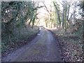
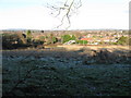
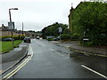
2
Bridleway leading from Tower Hill to Farthings Lane
Image: © Rod Allday
Taken: 16 Apr 2017
0.14 miles
5
Railway footbridge from the path on Tower Hill
Image: © Dave Spicer
Taken: 2 Jan 2010
0.18 miles
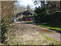
6
Hills Farm Road Horsham
The bridge in the distance runs over the River Arun.
Image: © Dave Spicer
Taken: 14 Sep 2011
0.18 miles
7
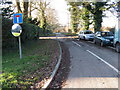
Looking east on Parthings Lane to junction with Tower Hill
Image: © Shazz
Taken: 3 Mar 2016
0.18 miles
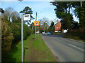
8
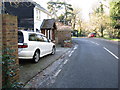
Handyman's house at the bend in Tower Hill
Image: © Dave Spicer
Taken: 2 Jan 2010
0.18 miles
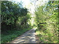
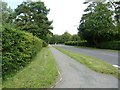
10
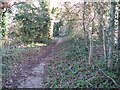
Footpath that runs parallel to Tower Hill
Image: © Dave Spicer
Taken: 2 Jan 2010
0.19 miles