IMAGES TAKEN NEAR TO
Chesworth Lane, HORSHAM, RH12 1GH
Introduction
This page details the photographs taken nearby to Chesworth Lane, RH12 1GH by members of the Geograph project.
The Geograph project started in 2005 with the aim of publishing, organising and preserving representative images for every square kilometre of Great Britain, Ireland and the Isle of Man.

There are currently over 7.5m images from over14,400 individuals and you can help contribute to the project by visiting https://www.geograph.org.uk
Image Map
Images are licensed for reuse under creativecommons.org/licenses/by-sa/2.0
Notes
- Clicking on the map will re-center to the selected point.
- The higher the marker number, the further away the image location is from the centre of the postcode.
Image Listing (538 Images Found)
Images are licensed for reuse under creativecommons.org/licenses/by-sa/2.0
Image
Details
Distance
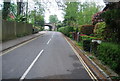
2
Approaching the junction of Denne Road and Fordingbridge Close
Image: © Basher Eyre
Taken: 22 Aug 2010
0.00 miles
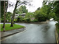
3
St Mary's Garden
Small cul-de-sac off Chesworth Lane.
Image: © N Chadwick
Taken: 2 May 2010
0.01 miles
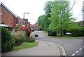
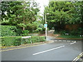
4
Junction of Chesworth Lane and Denne Road
Image: © Basher Eyre
Taken: 22 Aug 2010
0.01 miles
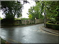
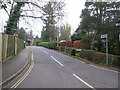
5
Road and footpath junction at the bottom of Denne Road
Image: © Basher Eyre
Taken: 22 Aug 2010
0.02 miles
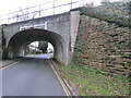
7
Junction of Denne Road and Chesworth Lane
Image: © Basher Eyre
Taken: 22 Aug 2010
0.03 miles
8
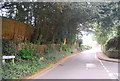
Public Footpath
Footpath FP1672/2 From Denne Road along Chesworth Lane
Image: © The Saunterer
Taken: 28 Nov 2012
0.03 miles
9
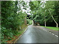
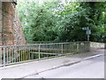
Looking down Denne Road to the railway bridge
Image: © Basher Eyre
Taken: 22 Aug 2010
0.03 miles
10
Ordnance Survey Bench mark
Cut Mark "PARA RLY BR S SIDE CHESWORTH LANE" 41.6875metres 0.4metres above ground.
Image: © The Saunterer
Taken: 28 Nov 2012
0.03 miles