IMAGES TAKEN NEAR TO
Arun Valley Way, HORSHAM, RH12 0BF
Introduction
This page details the photographs taken nearby to Arun Valley Way, RH12 0BF by members of the Geograph project.
The Geograph project started in 2005 with the aim of publishing, organising and preserving representative images for every square kilometre of Great Britain, Ireland and the Isle of Man.

There are currently over 7.5m images from over14,400 individuals and you can help contribute to the project by visiting https://www.geograph.org.uk
Image Map
Images are licensed for reuse under creativecommons.org/licenses/by-sa/2.0
Notes
- Clicking on the map will re-center to the selected point.
- The higher the marker number, the further away the image location is from the centre of the postcode.
Image Listing (70 Images Found)
Images are licensed for reuse under creativecommons.org/licenses/by-sa/2.0
Image
Details
Distance
2
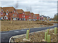
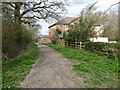
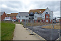
Housing on Arun Valley Way, Kilnwood Vale
Kilnwood Vale is a new development stuck on the west side of Crawley, but in Horsham District.
Image: © Robin Webster
Taken: 27 Mar 2021
0.08 miles
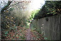
3
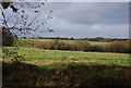
Houses on Manorfields, Bewbush, Crawley
Backing on to bridleway 1550.
Image: © Robin Webster
Taken: 27 Mar 2021
0.09 miles
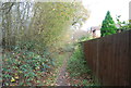
6
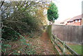
Bridleway 1550, Bewbush, Crawley
Along the west edge of Bewbush and Crawley Borough.
Image: © Robin Webster
Taken: 27 Mar 2021
0.10 miles
8
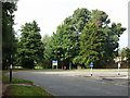
Roundabout on Sullivan Drive, Bewbush, Crawley
This is at a corner of Sullivan Drive, with no other roads off it.
Image: © Robin Webster
Taken: 22 Aug 2013
0.11 miles
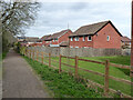
9
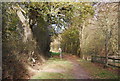
Housing on Arun Valley Way, Kilnwood Vale
Kilnwood Vale is a new development stuck on the west side of Crawley, but in Horsham District.
Image: © Robin Webster
Taken: 27 Mar 2021
0.11 miles