
IMAGES TAKEN NEAR TO
Station Road, REDHILL, RH1 1PN
Introduction
This page details the photographs taken nearby to Station Road, RH1 1PN by members of the Geograph project.
The Geograph project started in 2005 with the aim of publishing, organising and preserving representative images for every square kilometre of Great Britain, Ireland and the Isle of Man.

There are currently over 7.5m images from over14,400 individuals and you can help contribute to the project by visiting https://www.geograph.org.uk
Image Map
Images are licensed for reuse under creativecommons.org/licenses/by-sa/2.0
Notes
- Clicking on the map will re-center to the selected point.
- The higher the marker number, the further away the image location is from the centre of the postcode.
Image Listing (588 Images Found)
Images are licensed for reuse under creativecommons.org/licenses/by-sa/2.0
Image
Details
Distance
1
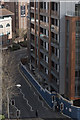
Queensway
View of the new development on Queensway bordering onto Station Road
Image: © Kurseong Carl
Taken: 3 Apr 2011
0.02 miles
2
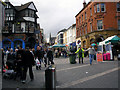
Station Road, Redhill
To the left is High Street, to the right is London Road. All effectively pedestrianised.
Image: © Dr Neil Clifton
Taken: 10 Feb 2007
0.02 miles
3
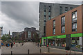
Station Road
Co-op food store in the ground floor of Nobel House (see Image).
Image: © Ian Capper
Taken: 5 Oct 2013
0.02 miles
4
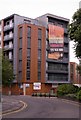
Nobel House
Completed in 2011, this new development consists of 126 flats, some of which are assigned to "key workers", with retail space on the ground floor it replaces the former Queensway House, containing a Lidl Supermarket, which itself had replaced the former Redhill branch of Safeways Supermarkets.
The name commemorates Alfred Nobel, inventor of dynamite and founder of the Nobel prizes, who first demonstrated dynamite in 1867 in a nearby Merstham Quarry.
Image: © Ian Capper
Taken: 29 Aug 2011
0.02 miles
5
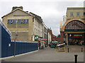
Station Road, Redhill
A pedestrianised shopping street in the centre of Redhill. On the right is the entrance to the Belfry Shopping Centre. The fencing to the left surrounds a development site for a 7 storey mixed retail/residential building, replacing a former Lidl (and before that Safeway) supermarket, the demolition of which revealed the old Bovril advert painted on the adjacent building.
Image: © Ian Capper
Taken: 23 Feb 2008
0.03 miles
6
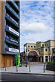
Station Road
Looking along the western section of Station Road. On the left is Nobel House, completed in 2011 and in the background is the Station Road entrance to The Belfry shopping centre.
Image: © Ian Capper
Taken: 16 Jun 2013
0.03 miles
7
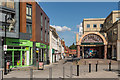
Station Road
Looking along the pedestrianised Station Road, with the entrance to the Belfry shopping centre on the right.
Image: © Ian Capper
Taken: 3 Aug 2014
0.03 miles
8
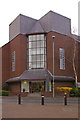
Betchworth House, Redhill
This building houses an office of the Valuation Office Agency (VOA).
Image: © Ian Capper
Taken: 24 Mar 2008
0.03 miles
9
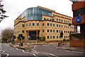
86 Station Road, Redhill
Head Office of Balfour Beatty Civil Engineering Limited
Image: © Ian Capper
Taken: 23 Mar 2008
0.04 miles
10
Entrance to 86 Station Road, Redhill
Image: © Ian Capper
Taken: 24 Mar 2008
0.04 miles