IMAGES TAKEN NEAR TO
Downland Drive, CRAWLEY, RH11 8SL
Introduction
This page details the photographs taken nearby to Downland Drive, RH11 8SL by members of the Geograph project.
The Geograph project started in 2005 with the aim of publishing, organising and preserving representative images for every square kilometre of Great Britain, Ireland and the Isle of Man.

There are currently over 7.5m images from over14,400 individuals and you can help contribute to the project by visiting https://www.geograph.org.uk
Image Map
Images are licensed for reuse under creativecommons.org/licenses/by-sa/2.0
Notes
- Clicking on the map will re-center to the selected point.
- The higher the marker number, the further away the image location is from the centre of the postcode.
Image Listing (75 Images Found)
Images are licensed for reuse under creativecommons.org/licenses/by-sa/2.0
Image
Details
Distance
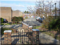
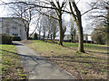
2
Path towards Caburn Heights, Southgate, Crawley
From the flats of Caburn Court.
Image: © Robin Webster
Taken: 7 Mar 2021
0.06 miles
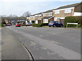
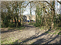
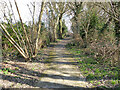
3
Captains Walk, Southgate, Crawley
A path along the high ground here, nearing its end on Downland Drive.
Image: © Robin Webster
Taken: 7 Mar 2021
0.07 miles
4
Path from Captains Walk to Caburn Court flats, Southgate, Crawley
Image: © Robin Webster
Taken: 7 Mar 2021
0.08 miles
5
Path to Hindhead Close, Southgate, Crawley
From the flats on the hill.
Image: © Robin Webster
Taken: 7 Mar 2021
0.08 miles
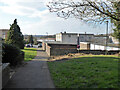
6
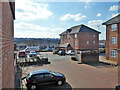
Flats, Downland Place, Southgate, Crawley
Image: © Robin Webster
Taken: 7 Mar 2021
0.09 miles
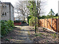
7
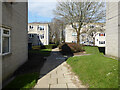
Path through flats, Caburn Court, Southgate, Crawley
Image: © Robin Webster
Taken: 7 Mar 2021
0.09 miles
8
Captains Walk, Southgate, Crawley
A path along the high ground here.
Image: © Robin Webster
Taken: 7 Mar 2021
0.09 miles
9
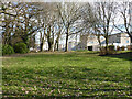
Green by flats, Caburn Court, Southgate, Crawley
Image: © Robin Webster
Taken: 7 Mar 2021
0.10 miles