IMAGES TAKEN NEAR TO
Swaledale Close, CRAWLEY, RH11 8SB
Introduction
This page details the photographs taken nearby to Swaledale Close, RH11 8SB by members of the Geograph project.
The Geograph project started in 2005 with the aim of publishing, organising and preserving representative images for every square kilometre of Great Britain, Ireland and the Isle of Man.

There are currently over 7.5m images from over14,400 individuals and you can help contribute to the project by visiting https://www.geograph.org.uk
Image Map
Images are licensed for reuse under creativecommons.org/licenses/by-sa/2.0
Notes
- Clicking on the map will re-center to the selected point.
- The higher the marker number, the further away the image location is from the centre of the postcode.
Image Listing (74 Images Found)
Images are licensed for reuse under creativecommons.org/licenses/by-sa/2.0
Image
Details
Distance
2
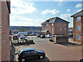
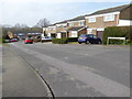
Flats, Downland Place, Southgate, Crawley
Image: © Robin Webster
Taken: 7 Mar 2021
0.10 miles
3
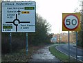
Signage approaching Cheals Roundabout from SE (A23).
View looking NW towards the roundabout.
Image: © Pete Chapman
Taken: 9 Dec 2005
0.10 miles
4
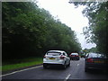
Crawley Avenue, Southgate
Crawley Avenue forms the western bypass of Crawley
Image: © David Howard
Taken: 16 Jul 2012
0.11 miles
5
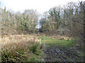
Rathlin Road Meadow, Pond and Wood, Crawley
A Crawley conservation area. To quote the council description: "This site has a marshy flood meadow, pond, brook and broad-leaved woodland. A pathway leads through the woodland and there are informal paths through other areas. All are uneven and can become very muddy".
Image: © Robin Webster
Taken: 7 Mar 2021
0.11 miles
6
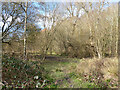
Rathlin Road Meadow, Pond and Wood, Crawley
A Crawley conservation area. To quote the council description: "This site has a marshy flood meadow, pond, brook and broad-leaved woodland. A pathway leads through the woodland and there are informal paths through other areas. All are uneven and can become very muddy".
Image: © Robin Webster
Taken: 7 Mar 2021
0.11 miles
7
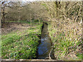
Broadfield Brook
In 'Rathlin Road Meadow, Pond and Wood', a Crawley conservation area. To quote the council description: "This site has a marshy flood meadow, pond, brook and broad-leaved woodland. A pathway leads through the woodland and there are informal paths through other areas. All are uneven and can become very muddy".
Image: © Robin Webster
Taken: 7 Mar 2021
0.13 miles
8
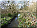
Rathlin Road Meadow, Pond and Wood, Crawley
A Crawley conservation area. To quote the council description: "This site has a marshy flood meadow, pond, brook and broad-leaved woodland. A pathway leads through the woodland and there are informal paths through other areas. All are uneven and can become very muddy". The brook - Broadfield Brook.
Image: © Robin Webster
Taken: 7 Mar 2021
0.13 miles
9
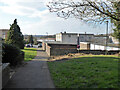
Path towards Caburn Heights, Southgate, Crawley
From the flats of Caburn Court.
Image: © Robin Webster
Taken: 7 Mar 2021
0.13 miles