
IMAGES TAKEN NEAR TO
Old Horsham Road, CRAWLEY, RH11 8PF
Introduction
This page details the photographs taken nearby to Old Horsham Road, RH11 8PF by members of the Geograph project.
The Geograph project started in 2005 with the aim of publishing, organising and preserving representative images for every square kilometre of Great Britain, Ireland and the Isle of Man.

There are currently over 7.5m images from over14,400 individuals and you can help contribute to the project by visiting https://www.geograph.org.uk
Image Map
Images are licensed for reuse under creativecommons.org/licenses/by-sa/2.0
Notes
- Clicking on the map will re-center to the selected point.
- The higher the marker number, the further away the image location is from the centre of the postcode.
Image Listing (57 Images Found)
Images are licensed for reuse under creativecommons.org/licenses/by-sa/2.0
Image
Details
Distance
1
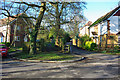
Path towards the A23
Towards the end of the old alignment of the Crawley - Horsham road, this way between the trees is one of two paths permitting pedestrians to reach the A23.
Image: © Robin Webster
Taken: 1 Jan 2010
0.03 miles
2
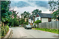
Old Horsham Road
Semi-detached houses in Old Horsham Road, seen in late evening light.
Image: © Ian Capper
Taken: 9 Aug 2018
0.04 miles
3
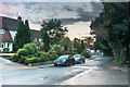
Old Horsham Road
Old Horsham Road by its junction with St Wilfrid's Way, seen in late evening light.
Image: © Ian Capper
Taken: 9 Aug 2018
0.09 miles
4
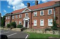
St Wilfrid's RC School
Catholic Comprehensive School, Crawley
Image: © Michael of Crawley
Taken: Unknown
0.09 miles
5
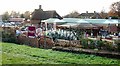
Squires Garden Centre, Crawley, West Sussex
On the site of the Cheals Garden Centre that the adjacent roundabout is named after.
Image: © Pete Chapman
Taken: 9 Dec 2005
0.10 miles
6
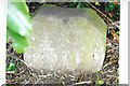
Old Milestone by A24, North of Kingsfold
The Milestone is located now in Crawley Museum, North Horsham Road, Crawley. Parish of Crawley (Crawley District). Carved stone post, Horsham stone design, erected by the Horsham & Dorking turnpike trust in the 19th Century. Some chips top and bottom.
Inscription reads:- (T)O / LOND(ON )/ 30 / MILES / TO WORTHING / 27 / MILES
Milestone Society National ID: SX_HSCW06L
Image: © Lionel Joseph
Taken: 1 Jan 2001
0.11 miles
7
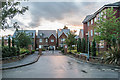
St Augustine Road
Gated development of St Wilfrid's Way completed in 2011-2 on the site of the original St Wilfrid's School, seen in late evening light.
Image: © Ian Capper
Taken: 9 Aug 2018
0.11 miles
8
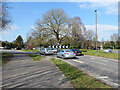
Cheal's Roundabout, Crawley
At the crossing of A2220 Horsham Road and A23 Crawley Avenue, the old Crawley bypass. The roundabout is named after the garden centre on the corner, which now has new management and name, so will the roundabout's name persist?
Image: © Robin Webster
Taken: 7 Mar 2021
0.11 miles
9
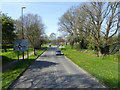
Horsham Road nearing Cheal's Roundabout, Crawley
The roundabout is on the A23 Crawley Bypass, and is named after the former name of a nearby garden centre.
Image: © Robin Webster
Taken: 18 Apr 2018
0.11 miles
10
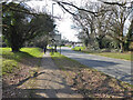
A2220 Horsham Road, Southgate, Crawley
Towards Horsham, Cheal's Roundabout on the A23 Crawley Avenue (the bypass road) is ahead.
Image: © Robin Webster
Taken: 7 Mar 2021
0.12 miles