
IMAGES TAKEN NEAR TO
Maiden Lane, CRAWLEY, RH11 7QU
Introduction
This page details the photographs taken nearby to Maiden Lane, RH11 7QU by members of the Geograph project.
The Geograph project started in 2005 with the aim of publishing, organising and preserving representative images for every square kilometre of Great Britain, Ireland and the Isle of Man.

There are currently over 7.5m images from over14,400 individuals and you can help contribute to the project by visiting https://www.geograph.org.uk
Image Map
Images are licensed for reuse under creativecommons.org/licenses/by-sa/2.0
Notes
- Clicking on the map will re-center to the selected point.
- The higher the marker number, the further away the image location is from the centre of the postcode.
Image Listing (64 Images Found)
Images are licensed for reuse under creativecommons.org/licenses/by-sa/2.0
Image
Details
Distance
1
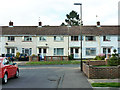
Houses on Maiden Lane, Langley Green, Crawley
Viewed from Heron Close.
Image: © Robin Webster
Taken: 30 Aug 2013
0.04 miles
2
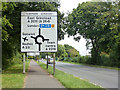
Road sign on A23, Crawley
The feature ahead, except for guided buses, is a simple roundabout with traffic lights at points round it. Why someone thought to call it a gyratory (which in my book is not a noun) is a mystery.
Image: © Robin Webster
Taken: 1 Sep 2013
0.05 miles
3
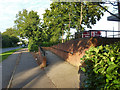
Cycle and pedestrian entrance, Sainsbury's, West Green, Crawley
A way up from the paths along the A23, but only officially from the near side of the road - the central reservation has railings along it.
Image: © Robin Webster
Taken: 30 Aug 2013
0.06 miles
4
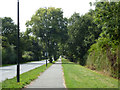
Path by A23, Crawley
This doubles as a footpath and cycle track.
Image: © Robin Webster
Taken: 1 Sep 2013
0.07 miles
5
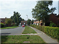
Martin Close, Langley Green, Crawley
Looking towards Swift Lane. The names of the lesser roads in this area have a bird theme.
Image: © Robin Webster
Taken: 1 Sep 2013
0.08 miles
6
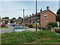
Houses on Jackdaw Close, Langley Green, Crawley
The names of the lesser roads in this area have a bird theme.
Image: © Robin Webster
Taken: 1 Sep 2013
0.08 miles
7
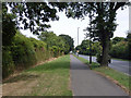
Path by A23, Crawley
This doubles as a footpath and cycle track.
Image: © Robin Webster
Taken: 1 Sep 2013
0.08 miles
8
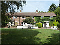
Houses on Robin Close, Langley Green, Crawley
The close ends in a small green surrounded by houses. These are on the north side.
Image: © Robin Webster
Taken: 1 Sep 2013
0.09 miles
9
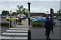
Sainsbury's Supermarket, West Green, Crawley, West Sussex
A (slightly) out of town superstore. Approximately 1km N of the town centre, this superstore is located close to a major road intersection between the A23 and the A2011 dual carriageway to the M23 motorway. Accessibility is one of the main reasons for this location. The site also includes a Homebase (Do-it-Yourself & Gardening) store and a drive through McDonald's (fast food).
Image: © Pete Chapman
Taken: 7 Jul 2005
0.09 miles
10
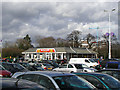
McDonald's Restaurant
Surrounded by the usual sea of cars outside J Sainsbury and Homebase. The crane in the background is working on the refurbishment of a hotel.
Image: © Andy Potter
Taken: 21 Mar 2008
0.10 miles