IMAGES TAKEN NEAR TO
Ewhurst Road, CRAWLEY, RH11 7HQ
Introduction
This page details the photographs taken nearby to Ewhurst Road, RH11 7HQ by members of the Geograph project.
The Geograph project started in 2005 with the aim of publishing, organising and preserving representative images for every square kilometre of Great Britain, Ireland and the Isle of Man.

There are currently over 7.5m images from over14,400 individuals and you can help contribute to the project by visiting https://www.geograph.org.uk
Image Map
Images are licensed for reuse under creativecommons.org/licenses/by-sa/2.0
Notes
- Clicking on the map will re-center to the selected point.
- The higher the marker number, the further away the image location is from the centre of the postcode.
Image Listing (70 Images Found)
Images are licensed for reuse under creativecommons.org/licenses/by-sa/2.0
Image
Details
Distance
1
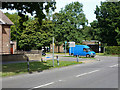
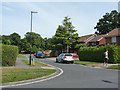
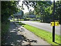
Corner of Ewhurst Road and Ifield Avenue, West Green, Crawley
Crawley local buses 1 and 2, and the country loop services 526 and 527 follow these roads, all turning left here.
Image: © Robin Webster
Taken: 1 Sep 2013
0.02 miles
2
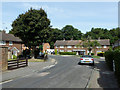
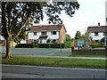
Houses on Furzefield, West Green, Crawley
A sort of crescent off Deerswood Road.
Image: © Robin Webster
Taken: 1 Sep 2013
0.05 miles
3
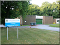
Crawley Ambulance Station
On Ifield Avenue, as is the fire station, further along.
Image: © Robin Webster
Taken: 30 Aug 2013
0.06 miles
4
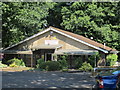
Club Building, West Green Park, Crawley
This is home to the Crawley Labour Supporters Sports and Social Club
Image: © Richard Rogerson
Taken: 3 Jul 2011
0.07 miles
5
Houses on Little Crabtree, West Green, Crawley
Little Crabtree is a residential road in parallel with Ifield Avenue in the foreground.
Image: © Robin Webster
Taken: 30 Aug 2013
0.07 miles
6
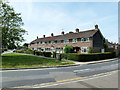
Houses on Ewhurst Road, West Green, Crawley
At the corner of Deerswood Road.
Image: © Robin Webster
Taken: 1 Sep 2013
0.08 miles
7
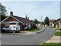
Copse Crescent, West Green, Crawley
A close with small bungalows on one side and access to the rear of houses on Ewhurst and Crabtree Roads on the other.
Image: © Robin Webster
Taken: 1 Sep 2013
0.09 miles
8
Little Crabtree, West Green, Crawley
A turning off Crabtree Road.
Image: © Robin Webster
Taken: 1 Sep 2013
0.10 miles
9
A23 near Ifield Roundabout, Crawley
As the name suggests, Scholars Field is a housing redevelopment of a school playing field.
Image: © Robin Webster
Taken: 31 Aug 2013
0.10 miles
10
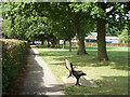
Path, West Green Park, Crawley
Ifield Avenue is over the hedge on the left.
Image: © Robin Webster
Taken: 1 Sep 2013
0.10 miles