
IMAGES TAKEN NEAR TO
Ifield Road, CRAWLEY, RH11 7AS
Introduction
This page details the photographs taken nearby to Ifield Road, RH11 7AS by members of the Geograph project.
The Geograph project started in 2005 with the aim of publishing, organising and preserving representative images for every square kilometre of Great Britain, Ireland and the Isle of Man.

There are currently over 7.5m images from over14,400 individuals and you can help contribute to the project by visiting https://www.geograph.org.uk
Image Map
Images are licensed for reuse under creativecommons.org/licenses/by-sa/2.0
Notes
- Clicking on the map will re-center to the selected point.
- The higher the marker number, the further away the image location is from the centre of the postcode.
Image Listing (308 Images Found)
Images are licensed for reuse under creativecommons.org/licenses/by-sa/2.0
Image
Details
Distance
1
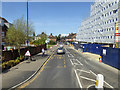
Ifield Road, Crawley
The building under construction on the right is for flats on what was a car dealers and then a make-shift car park.
Image: © Robin Webster
Taken: 18 Apr 2018
0.01 miles
2
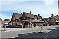
The former Rose and Crown, Ifield Road, West Green, Crawley
Closed by the authorities after repeated trouble, it is now Hallan cash and carry, catering for the Asian market.
Image: © Robin Webster
Taken: 13 Aug 2013
0.02 miles
3
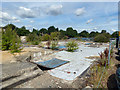
Waste land, Crawley
The site of a former car dealership that moved further out of town. The forecourt areas are currently used as a car park, but the areas where buildings were are waste. No doubt the area will be redeveloped before long.
Image: © Robin Webster
Taken: 13 Aug 2013
0.03 miles
4
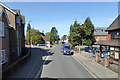
Ifield Road, Crawley
Horsham Road branches off to the left ahead.
Image: © Robin Webster
Taken: 18 Apr 2018
0.04 miles
5
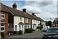
Houses, Victoria Road, West Green, Crawley
One has a blue plaque recording the lodgings in 1905 - 1906 of Francis Thompson (1859 - 1907), poet and essayist.
Image: © Robin Webster
Taken: 13 Aug 2013
0.05 miles
6
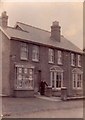
16 Ifield Road, Crawley, Sussex
Taken probably between 1905 and 1923 by the Godsmark family, who lived here and ran the shop as a hairdressers. The building was in the area designated for a relief road from the 1970s and consequently fell into disrepair, before being renovated for use as temporary offices in 1978. When the relief road (Pegler Way) was eventually built it wasn't actually necessary to demolish this house. The house was eventually demolished along with several of its neighbours in the preparatory works to make way for the ASDA supermarket which opened in 2003. Permission has now been granted for a six storey block of flats on this end of the ASDA site.
Image: © Godsmark Family
Taken: Unknown
0.06 miles
7
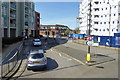
Ifield Road, Crawley
The building under construction on the right is for flats on what was a car dealers and then a make-shift car park.
Image: © Robin Webster
Taken: 18 Apr 2018
0.06 miles
8
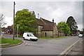
St Peters Crawley
There was a book sale on in the Church hall on the day I visited.
Image: © Glyn Baker
Taken: 4 May 2013
0.07 miles
9
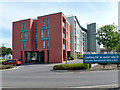
Pegler Court, Crawley
A new block of flats, viewed across one of the entrances to the Asda car park.
Image: © Robin Webster
Taken: 13 Aug 2013
0.07 miles
10
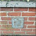
Commemoration of a non-event, West Green Road, Crawley
It is nice to see that non-events are remembered as well as recognized events. Fair shares for all, I say.
Image: © Robin Webster
Taken: 5 Nov 2019
0.07 miles