
IMAGES TAKEN NEAR TO
Stevenage Road, CRAWLEY, RH11 6EN
Introduction
This page details the photographs taken nearby to Stevenage Road, RH11 6EN by members of the Geograph project.
The Geograph project started in 2005 with the aim of publishing, organising and preserving representative images for every square kilometre of Great Britain, Ireland and the Isle of Man.

There are currently over 7.5m images from over14,400 individuals and you can help contribute to the project by visiting https://www.geograph.org.uk
Image Map
Images are licensed for reuse under creativecommons.org/licenses/by-sa/2.0
Notes
- Clicking on the map will re-center to the selected point.
- The higher the marker number, the further away the image location is from the centre of the postcode.
Image Listing (41 Images Found)
Images are licensed for reuse under creativecommons.org/licenses/by-sa/2.0
Image
Details
Distance
1
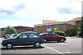
Bewbush Leisure Centre
Crawley's second leisure Centre, opened in 1984, demolished in 2009.
Image: © Michael of Crawley
Taken: Unknown
0.04 miles
2
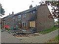
Fire damaged house, Skelmersdale Walk, Bewbush, Crawley
This estate has a new town theme - the roads and walks are named after other new towns throughout the country. The road behind this house is Stevenage Road.
According to the local paper:
"A house fire caused by a firework thrown into a garden is being treated as suspicious, say police. A family was evacuated from their home in the early hours of Friday (August 2) after a firework landed in the garden and their garden furniture caught fire. The fire then spread to the house. Three fire crews and police were called to the house in Stevenage Road, Bewbush, at about 1.30am."
Image: © Robin Webster
Taken: 22 Aug 2013
0.07 miles
3
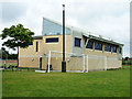
Sports pavilion, Bewbush, Crawley
By the site of a closed and demolished leisure centre, this is a new building a little south of where the old buildings were.
Image: © Robin Webster
Taken: 22 Aug 2013
0.07 miles
4
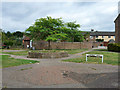
Hatfield Walk, Bewbush, Crawley
This estate has an octagon theme, with a few small octagonal islands of greenery among the alleys and roads, and a brick-paved area here. It also has a new town theme - the roads and walks are named after other new towns throughout the country.
Image: © Robin Webster
Taken: 22 Aug 2013
0.08 miles
5
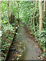
Douster Brook, Bewbush, Crawley
An artificially straight concrete channel here, but with a kink ahead, that seems to avoid a large tree.
Image: © Robin Webster
Taken: 22 Aug 2013
0.11 miles
6
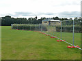
Site fence, leisure centre redevelopment
Bewbush Leisure centre was closed and demolished, and this fence is around the site. Ground works are now in progress for something, probably houses. The building is a new but smaller sports pavilion substitute for the centre, built a little south of the old site.
Image: © Robin Webster
Taken: 22 Aug 2013
0.11 miles
7
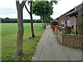
Skelmersdale Walk, Bewbush, Crawley
Houses facing a playing field, with road access at the back. This estate has a new town theme - the roads and walks are named after other new towns throughout the country.
Image: © Robin Webster
Taken: 22 Aug 2013
0.11 miles
8
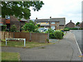
Cumbernauld Walk meets Basildon Way, Bewbush, Crawley
This estate has a new town theme - the roads and walks are named after other new towns throughout the country.
Image: © Robin Webster
Taken: 22 Aug 2013
0.12 miles
9
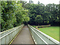
Ramp down from A2220 footbridge
A route connecting the Bewbush neighbourhood of Crawley with Buchan Country Park.
Image: © Robin Webster
Taken: 22 Aug 2013
0.13 miles
10
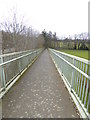
Long slope from footbridge to ground
See also http://www.geograph.org.uk/photo/3615246.
Image: © Shazz
Taken: 3 Apr 2016
0.13 miles