IMAGES TAKEN NEAR TO
Lovell Path, CRAWLEY, RH11 0RH
Introduction
This page details the photographs taken nearby to Lovell Path, RH11 0RH by members of the Geograph project.
The Geograph project started in 2005 with the aim of publishing, organising and preserving representative images for every square kilometre of Great Britain, Ireland and the Isle of Man.

There are currently over 7.5m images from over14,400 individuals and you can help contribute to the project by visiting https://www.geograph.org.uk
Image Map
Images are licensed for reuse under creativecommons.org/licenses/by-sa/2.0
Notes
- Clicking on the map will re-center to the selected point.
- The higher the marker number, the further away the image location is from the centre of the postcode.
Image Listing (102 Images Found)
Images are licensed for reuse under creativecommons.org/licenses/by-sa/2.0
Image
Details
Distance
6
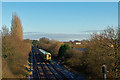
Railway west of Ifield
A class 377 unit heads away from Ifield towards Horsham.
Image: © Robin Webster
Taken: 2 Jan 2010
0.08 miles
9
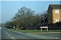
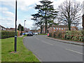
Junction of Hyde Drive and Drummond Road
Image: © Peter Shimmon
Taken: 1 Jan 1984
0.09 miles
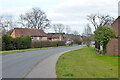
10
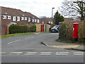
Hanbury Road turns off Hyde Drive, Ifield, Crawley
The postbox is number RH11 141D.
Image: © Robin Webster
Taken: 21 Mar 2021
0.09 miles