IMAGES TAKEN NEAR TO
Shipley Road, CRAWLEY, RH11 0EF
Introduction
This page details the photographs taken nearby to Shipley Road, RH11 0EF by members of the Geograph project.
The Geograph project started in 2005 with the aim of publishing, organising and preserving representative images for every square kilometre of Great Britain, Ireland and the Isle of Man.

There are currently over 7.5m images from over14,400 individuals and you can help contribute to the project by visiting https://www.geograph.org.uk
Image Map
Images are licensed for reuse under creativecommons.org/licenses/by-sa/2.0
Notes
- Clicking on the map will re-center to the selected point.
- The higher the marker number, the further away the image location is from the centre of the postcode.
Image Listing (49 Images Found)
Images are licensed for reuse under creativecommons.org/licenses/by-sa/2.0
Image
Details
Distance
1
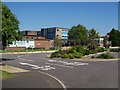
The Mill Primary School, Crawley
Former buildings of Henry Pelham School, and more recently Ifield Middle, and then Ifield First & Middle Schools. The Mill Primary opened in September 2004.
Image: © Michael of Crawley
Taken: 5 Aug 2007
0.06 miles
2
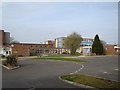
The Mill Primary School
Primary school, formerly first and middle, previously middle, and secondary.
Image: © Michael of Crawley
Taken: 6 Apr 2009
0.09 miles
3
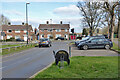
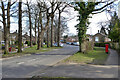
Tangmere Road meets Ifield Drive, Ifield, Crawley
Image: © Robin Webster
Taken: 21 Mar 2021
0.11 miles
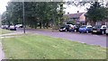
6
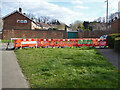
Footpath closed, Treyford Close, Ifield, Crawley
Part of a widespread campaign in this area - the installation of full-fibre broadband for CityFibre.
Image: © Robin Webster
Taken: 21 Mar 2021
0.15 miles

8
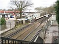
Ifield railway station (1)
The London Brighton & South Coast Railway opened their line to Horsham through here in 1848, but the station was not built until 1907. When it was opened it was briefly known as Lyons Crossing Halt, presumably after the Lion's Farm just to the south, becoming Ifield Halt later that year. After a brief closure at the end of the First World War it reopened in 1920 and became just Ifield in 1930.
There used to be a level crossing here, at the foot of the platform ramp, connecting what is now Ifield Drive, to the north and left, and what is now Craigans to the south and right. The Craigan was the name of a house next to Lion's Farm.
For a view of the station in the opposite direction please see Image
Image: © Nigel Cox
Taken: 24 Jan 2010
0.16 miles
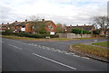
10
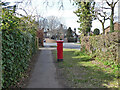
Postbox on Tangmere Road, Ifield, Crawley
Number RH11 103D.
Image: © Robin Webster
Taken: 21 Mar 2021
0.16 miles