IMAGES TAKEN NEAR TO
Green Lane, CRAWLEY, RH10 8JX
Introduction
This page details the photographs taken nearby to Green Lane, RH10 8JX by members of the Geograph project.
The Geograph project started in 2005 with the aim of publishing, organising and preserving representative images for every square kilometre of Great Britain, Ireland and the Isle of Man.

There are currently over 7.5m images from over14,400 individuals and you can help contribute to the project by visiting https://www.geograph.org.uk
Image Map
Images are licensed for reuse under creativecommons.org/licenses/by-sa/2.0
Notes
- Clicking on the map will re-center to the selected point.
- The higher the marker number, the further away the image location is from the centre of the postcode.
Image Listing (48 Images Found)
Images are licensed for reuse under creativecommons.org/licenses/by-sa/2.0
Image
Details
Distance
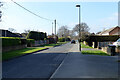
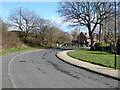
4
Green Lane, Crawley
The A2011 is on the left beyond the fence, and divides the industrial area from this residential area. A foot and cycleway beneath the main road passes in front of the house. The foreground bend is a "new town" modification of the original course of Green Lane.
Image: © Robin Webster
Taken: 1 Jan 2010
0.07 miles
5

Subway under A2011 Crawley Avenue
A way from where people live to where they work.
Image: © Robin Webster
Taken: 28 Feb 2021
0.08 miles
6
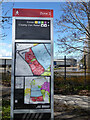
Zoning information board for Manor Royal, Crawley
Manor Royal was the main Crawley industrial area, now rebranded with some accuracy as the Business District. Industry has waned, desk jobs waxed.
Image: © Robin Webster
Taken: 13 Mar 2021
0.09 miles
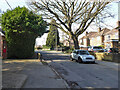
8
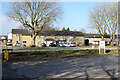
Houses on Woodfield Road, Northgate, Crawley
Image: © Robin Webster
Taken: 28 Feb 2021
0.11 miles
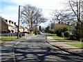
9
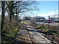
Path towards Tushmore Lane, Northgate, Crawley
Preserving some sort of link between the parts of the severed lane to either side of the New Town road Crawley Avenue. The part of the lane south of Crawley Avenue has been renamed as a continuation of Green Lane.
Image: © Robin Webster
Taken: 13 Mar 2021
0.12 miles
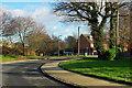
10
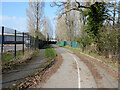
Foot and cycle route to Manor Royal, Crawley
Through the southern part of the industrial area.
Image: © Robin Webster
Taken: 28 Feb 2021
0.13 miles