
IMAGES TAKEN NEAR TO
Owletts, CRAWLEY, RH10 7SQ
Introduction
This page details the photographs taken nearby to Owletts, RH10 7SQ by members of the Geograph project.
The Geograph project started in 2005 with the aim of publishing, organising and preserving representative images for every square kilometre of Great Britain, Ireland and the Isle of Man.

There are currently over 7.5m images from over14,400 individuals and you can help contribute to the project by visiting https://www.geograph.org.uk
Image Map
Images are licensed for reuse under creativecommons.org/licenses/by-sa/2.0
Notes
- Clicking on the map will re-center to the selected point.
- The higher the marker number, the further away the image location is from the centre of the postcode.
Image Listing (93 Images Found)
Images are licensed for reuse under creativecommons.org/licenses/by-sa/2.0
Image
Details
Distance
1
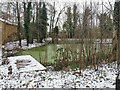
Pond by Balcombe Road, Pound Hill, Crawley
Image: © Robin Webster
Taken: 10 Feb 2021
0.02 miles
2
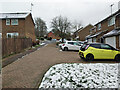
A branch of Lytton Drive, Pound Hill, Crawley
Image: © Robin Webster
Taken: 10 Feb 2021
0.03 miles
3
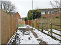
Path from Balcombe Road to residential roads, Pound Hill, Crawley
Paths branch to several different roads from here on.
Image: © Robin Webster
Taken: 10 Feb 2021
0.03 miles
4
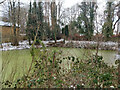
Pond by Balcombe Road, Pound Hill, Crawley
Image: © Robin Webster
Taken: 10 Feb 2021
0.03 miles
5
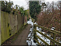
Path from Balcombe Road to residential roads, Pound Hill, Crawley
Running beside a pond on the right.
Image: © Robin Webster
Taken: 10 Feb 2021
0.04 miles
6
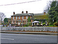
Hillside Inn, Pound Hill, Crawley
On Balcombe Road.
Image: © Robin Webster
Taken: 1 Jan 2015
0.04 miles
7

Inn sign, Hillside Inn, Pound Hill, Crawley
Image: © Robin Webster
Taken: 21 Feb 2021
0.04 miles
8
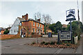
Hillside Inn, Pound Hill, Crawley
On Balcombe Road, a grade II listed building, when first listed in 1983 it was 'Hillside Kennels and Antique Centre'. The front is 19th century, the rear may be 17th century.
Image: © Robin Webster
Taken: 21 Feb 2021
0.04 miles
9
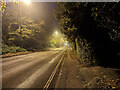
B2036 Balcombe Road, Pound Hill, Crawley
Quiet, as the road was closed at and including Worth Corner for overnight resurfacing.
Image: © Robin Webster
Taken: 30 Nov 2022
0.04 miles
10
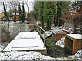
Drainage installation, pond by Balcombe Road
An old pond, but used in modern drainage. These appear to be discharges, at least on the right, from underground systems. At the other end of the pond is something similar to the near thing with railings, perhaps both are outlets.
Image: © Robin Webster
Taken: 10 Feb 2021
0.05 miles