
IMAGES TAKEN NEAR TO
Barn Close, CRAWLEY, RH10 7PE
Introduction
This page details the photographs taken nearby to Barn Close, RH10 7PE by members of the Geograph project.
The Geograph project started in 2005 with the aim of publishing, organising and preserving representative images for every square kilometre of Great Britain, Ireland and the Isle of Man.

There are currently over 7.5m images from over14,400 individuals and you can help contribute to the project by visiting https://www.geograph.org.uk
Image Map
Images are licensed for reuse under creativecommons.org/licenses/by-sa/2.0
Notes
- Clicking on the map will re-center to the selected point.
- The higher the marker number, the further away the image location is from the centre of the postcode.
Image Listing (157 Images Found)
Images are licensed for reuse under creativecommons.org/licenses/by-sa/2.0
Image
Details
Distance
1
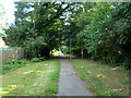
Former course of Blackwater Lane, Pound Hill, Crawley
This section of the lane was demoted to a footpath during the development of Crawley New Town. The lane, formerly connecting to Balcombe Road ahead, was diverted to connect to Worth Road. Much earlier, before the building of the section of Balcombe Road here in the early 19th century, the route continued further on straight ahead down what is now Green Lane (partly a footpath now) to connect to Church Lane, then the main road.
Image: © Robin Webster
Taken: 8 Aug 2013
0.01 miles
2
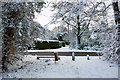
Looking across Balcombe Road to Green Lane, Crawley
After an overnight fall of snow.
Image: © Robin Webster
Taken: 18 Dec 2009
0.02 miles
3
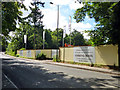
Demolition site, Balcombe Road, Pound Hill, Crawley
'Crossways', a large house with a fair sized garden, has lately been demolished, and site preparation for the builders to move in for the housing redevelopment continues.
Image: © Robin Webster
Taken: 9 Aug 2013
0.03 miles
4
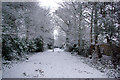
Former course of Blackwater Lane, Pound Hill, Crawley
This section of the lane was demoted to a footpath during the development of Crawley New Town. The lane, formerly connecting to Balcombe Road behind the camera, was diverted to connect to Worth Road.
Image: © Robin Webster
Taken: 24 Jan 2007
0.04 miles
5
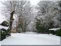
Snowy bend on Blackwater Lane
The road now does a sharp left turn here, but once continued straight on to meet Balcombe Road. That part is now a footpath only.
Image: © Robin Webster
Taken: 5 Feb 2012
0.04 miles
8
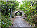
Worth Way, just before passing under B2036, Crawley
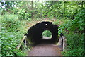
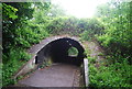
The disused railway between Crawley and East Grinstead was converted into a hard surfaced route for non-motorised traffic. Here we see the route heading towards E. Grinstead, just before passing under the Balcombe Road. The tunnel is not an original from the days when steam trains used to ply this route.
Image: © Robin Webster
Taken: 8 Oct 2020
0.05 miles
9
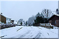
Blackwater Lane
The 'new town' part of the lane. Formerly the old lane crossed from left to right in the immediate foreground, but a right-angled bend was inserted during the new town development to connect to this new section. It leads to Worth Road rather than Balcombe Road, with the Balcombe Road route demoted to a footpath.
Image: © Robin Webster
Taken: 24 Jan 2007
0.05 miles
10
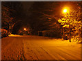
Twilight of the sodium lamp
Only a matter of days left to see this cosy glow on Blackwater Lane, where street lamps are scheduled to be replaced with more efficient lighting. It had just about stopped snowing, with a cold night forecast.
Image: © Robin Webster
Taken: 20 Jan 2013
0.05 miles