IMAGES TAKEN NEAR TO
Greatham Road, CRAWLEY, RH10 7JJ
Introduction
This page details the photographs taken nearby to Greatham Road, RH10 7JJ by members of the Geograph project.
The Geograph project started in 2005 with the aim of publishing, organising and preserving representative images for every square kilometre of Great Britain, Ireland and the Isle of Man.

There are currently over 7.5m images from over14,400 individuals and you can help contribute to the project by visiting https://www.geograph.org.uk
Image Map
Images are licensed for reuse under creativecommons.org/licenses/by-sa/2.0
Notes
- Clicking on the map will re-center to the selected point.
- The higher the marker number, the further away the image location is from the centre of the postcode.
Image Listing (66 Images Found)
Images are licensed for reuse under creativecommons.org/licenses/by-sa/2.0
Image
Details
Distance
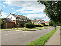
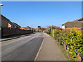
1
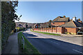
Pallingham Drive, Maidenbower, Crawley
A principal road of the neighbourhood.
Image: © Robin Webster
Taken: 2 Mar 2023
0.03 miles
3
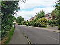
Matthews Drive, Maidenbower
This southern part follows the Stanford Brook, down on the left.
Image: © Robin Webster
Taken: 11 Jul 2020
0.06 miles
5
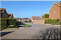
Matthews Drive, Maidenbower
South from here the road follows the Stanford Brook, off to the right over this part.
Image: © Robin Webster
Taken: 11 Jul 2020
0.09 miles
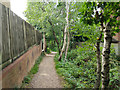
6
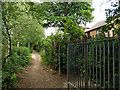
Footpath 81W, Maidenbower
Between the back fences of Maidenbower, following approximately the course of a former track to and past the former Forest Farm. Both of these have been obliterated under the Maidenbower development.
Image: © Robin Webster
Taken: 11 Jul 2020
0.09 miles
7
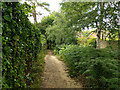
Footpath 81W, Maidenbower
Between the back fences of Maidenbower, following approximately the course of a former track to and past the former Forest Farm. Both of these have been obliterated under the Maidenbower development.
Image: © Robin Webster
Taken: 11 Jul 2020
0.09 miles
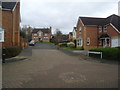
9
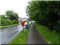
Harper Drive, Maidenbower, Crawley
On the 100 bus route.
Image: © Robin Webster
Taken: 2 Mar 2023
0.09 miles
10
Footpath 81W, Maidenbower
Between the back fences of Maidenbower, following approximately the course of a former track to and past the former Forest Farm. Both of these have been obliterated under the Maidenbower development.
Image: © Robin Webster
Taken: 11 Jul 2020
0.10 miles