
IMAGES TAKEN NEAR TO
Goddard Close, CRAWLEY, RH10 7HR
Introduction
This page details the photographs taken nearby to Goddard Close, RH10 7HR by members of the Geograph project.
The Geograph project started in 2005 with the aim of publishing, organising and preserving representative images for every square kilometre of Great Britain, Ireland and the Isle of Man.

There are currently over 7.5m images from over14,400 individuals and you can help contribute to the project by visiting https://www.geograph.org.uk
Image Map
Images are licensed for reuse under creativecommons.org/licenses/by-sa/2.0
Notes
- Clicking on the map will re-center to the selected point.
- The higher the marker number, the further away the image location is from the centre of the postcode.
Image Listing (51 Images Found)
Images are licensed for reuse under creativecommons.org/licenses/by-sa/2.0
Image
Details
Distance
2
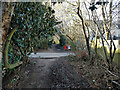
Footpath 81W, Maidenbower, Crawley
Towards a bridge over the railway and Tilgate Park. Just ahead is a crossing of a path between the ends of Penfold Road and Holder Road.
Image: © Robin Webster
Taken: 26 Feb 2022
0.07 miles
3
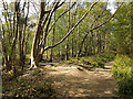
Swinging tree, Tilgate Park
Of the unofficial rope and crossbar type.
Image: © Robin Webster
Taken: 26 Apr 2020
0.08 miles
4
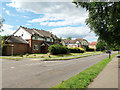
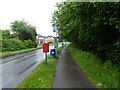
Matthews Drive, Maidenbower
South from here the road follows the Stanford Brook, off to the right over this part.
Image: © Robin Webster
Taken: 11 Jul 2020
0.09 miles
5
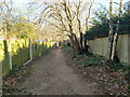
Footpath 81W, Maidenbower, Crawley
Towards Matthews Drive.
Image: © Robin Webster
Taken: 26 Feb 2022
0.09 miles
8
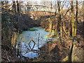
Pond by railway south of Three Bridges
Beyond is the footbridge for path 81W. This was once, before the development of Maidenbower, a level foot crossing. The pond is associated with further excavations and banks behind the camera, and was outside railway property until this was widened rather generously to accommodate the quadrupling of the line in the early 20th century.
Image: © Robin Webster
Taken: 26 Feb 2022
0.10 miles
9
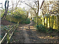
Footpath 81W, Maidenbower, Crawley
Towards a bridge over the railway and Tilgate Park.
Image: © Robin Webster
Taken: 26 Feb 2022
0.10 miles
10
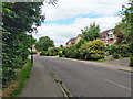
Matthews Drive, Maidenbower
This southern part follows the Stanford Brook, down on the left.
Image: © Robin Webster
Taken: 11 Jul 2020
0.11 miles