IMAGES TAKEN NEAR TO
Cherrytree Close, CRAWLEY, RH10 7FR
Introduction
This page details the photographs taken nearby to Cherrytree Close, RH10 7FR by members of the Geograph project.
The Geograph project started in 2005 with the aim of publishing, organising and preserving representative images for every square kilometre of Great Britain, Ireland and the Isle of Man.

There are currently over 7.5m images from over14,400 individuals and you can help contribute to the project by visiting https://www.geograph.org.uk
Image Map
Images are licensed for reuse under creativecommons.org/licenses/by-sa/2.0
Notes
- Clicking on the map will re-center to the selected point.
- The higher the marker number, the further away the image location is from the centre of the postcode.
Image Listing (70 Images Found)
Images are licensed for reuse under creativecommons.org/licenses/by-sa/2.0
Image
Details
Distance
1
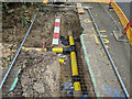
Hole on Balcombe Road
Gas pipes were being replaced.
Image: © Robin Webster
Taken: 31 Jul 2022
0.03 miles
2
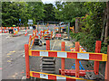
Work on Balcombe Road
The road was closed as a through route from Worth Corner northwards to Ridley's Corner Roundabout just ahead. Gas pipes were being replaced.
Image: © Robin Webster
Taken: 31 Jul 2022
0.04 miles
4
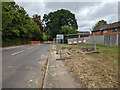
Work on Balcombe Road
The road was closed as a through route from Worth Corner northwards to Ridley's Corner Roundabout (A2220). Gas pipes were being replaced.
Image: © Robin Webster
Taken: 31 Jul 2022
0.05 miles
5
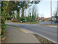
Ridley's Corner roundabout, Pound Hill, Crawley
The A2220 crosses the B2036.
Image: © Robin Webster
Taken: 21 Feb 2021
0.06 miles
6
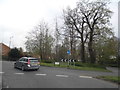
Ridley's Corner Roundabout, Pound Hill
Image: © David Howard
Taken: 26 Apr 2015
0.06 miles
7
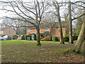
Houses on Oakfields, Pound Hill, Crawley
Image: © Robin Webster
Taken: 2 Feb 2021
0.08 miles
8
A2220 Worth Park Avenue, Pound Hill, Crawley
Image: © Robin Webster
Taken: 21 Feb 2021
0.09 miles
9
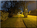
Path by The Ridings, Pound Hill, Crawley
Image: © Robin Webster
Taken: 5 Mar 2023
0.09 miles
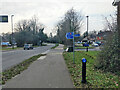
10
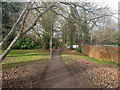
Path towards Copthorne Road
There is an eastbound bus stop on the road, and also a path up to housing on the other side.
Image: © Robin Webster
Taken: 2 Feb 2021
0.10 miles